Location
Mount Vernon, WA 98274
Location
Mount Vernon, WA 98274

Scientists have produced the most detailed map to date of subglacial rivers coursing beneath Antarctica's ice sheet, revealing complex networks that shape meltwater pathways and influence global sea levels. This breakthrough combines satellite remote sensing, in situ seismic arrays, and AI-driven models to shed light on hidden water flows and their climatic implications.
Scientists have unveiled the most detailed map to date of subglacial rivers flowing beneath Antarctica’s vast ice sheet, exposing hidden corridors of meltwater that guide the fate of distant coastlines. This landmark project stitches decades of scattered observations with cutting-edge computational methods, transforming faint signals into a high-resolution portrait of frozen terrain in motion.
Those hidden currents play a vital role in ice sheet stability. Meltwater sluices at the base can lubricate the bedrock interface and accelerate glacier movements. By charting these pathways, researchers hope to refine predictions of sea-level rise and identify early warning signs of rapid ice loss.
Satellite radar altimetry data provided the first clues, tracking minute changes in surface elevation over time. Gravity measurements from polar orbiters complemented this picture by revealing mass redistributions as chambers fill and drain. Together, these remote techniques formed the backbone of a continental survey.
In situ instruments added another layer of detail. Arrays of seismic sensors planted on the ice surface detected the distinct tremors of flowing water beneath kilometers of ice. Combined with GPS stations tracking subtle ground shifts, the network delivered unprecedented insight into the rhythms of subglacial drainage.
Artificial intelligence tied these disparate streams together. A neural network trained on synthetic flow models ingested terabytes of sensor readings and satellite imagery to produce a continuous map with meter-scale resolution. The result captures dynamic shifts in river channels as pressure builds and release events cascade through the system.
Some discoveries surprised even veteran glaciologists. Meandering streams stretch for hundreds of kilometers in branching patterns more complex than any known river system on the surface. Hidden reservoirs accumulate beneath ridges before bursting forth, reshaping catchments in weeks rather than centuries.
Understanding these processes matters for global coastlines. When basal water reaches the grounding line, where ice lifts off bedrock into the sea, it can trigger rapid retreat. By pinpointing hotspots of subglacial flow, modelers can improve forecasts of how and when vulnerable glaciers might slip into irreversible decline.
The collaboration spanned disciplines. Glaciologists guided field campaigns and interpreted ice dynamics. Geophysicists fine-tuned seismic arrays and processed waveforms. Engineers developed autonomous probes capable of drilling through ice shelves and deploying sensors in isolated cavities.
Next phases of the project will deploy underwater vehicles into boreholes and subglacial lakes. These craft, equipped with sonar and camera systems, will trace river channels in three dimensions and sample water chemistry. Such direct exploration promises to reveal the microbial ecosystems that thrive in utter darkness.
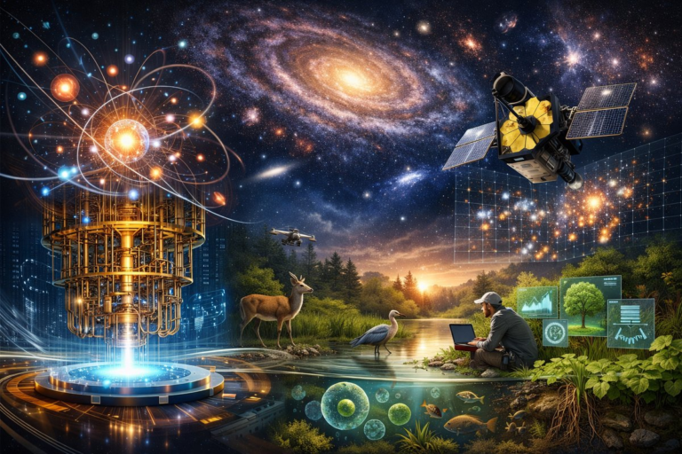
Although this research focused on Antarctica, the techniques have cosmic parallels. Just as astronomers infer the structure of distant galaxies from faint light, polar scientists combine remote measurements and models to peer beneath barriers of ice. Both efforts demand patience, precision, and a willingness to follow the faintest of signals.
Every instrument underwent rigorous calibration under simulated cold and pressure extremes. Lab teams subjected sensors to saltwater floods and mechanical shocks to ensure reliable readings thousands of meters below the surface. This meticulous work underpins the trustworthiness of the final map.
Beyond academic interest, the findings inform climate policy. Coastal planners in low-lying regions can use refined sea-level projections to set building codes and evacuation thresholds. Insurers and governments gain better tools to weigh long-term risk and invest in resilience.
Open data practices are central to the initiative. Raw measurements, processed datasets, and model code are published on public repositories. By inviting external validation and collaborative refinement, the research community accelerates progress and fosters transparency.
Yet much remains unknown. Even now, glaciologists debate how subglacial channels evolve under changing melt regimes driven by warming air and ocean waters. Seasonal shifts can cause abrupt reorganizations of drainage networks, challenging forecast models tuned to static assumptions.
Similar techniques can be scaled to other polar regions. Greenland’s ice sheet, though smaller, plays an outsized role in near-term sea-level projections. Deploying the same sensor suites and modeling workflows there could reveal whether hidden rivers beneath Greenland pose an even greater threat.
At the smallest scale, insights from quantum-enhanced sensors promise to sharpen seismic readings and detect tremors below the threshold of classical instruments. By harnessing novel materials and quantum interference, next-generation detectors could reveal the finest details of water flow under pressure.
Public engagement has already brought unexpected benefits. Citizen science volunteers have helped process aerial photographs of ice fissures and annotate satellite imagery for early signs of meltwater pooling. Their contributions speed up the cycle of model refinement and build a shared sense of exploration.
Ethical questions arise when deploying instruments on pristine ice. Researchers strive to minimize the environmental footprint of field camps and avoid contaminating subglacial habitats. Strict protocols govern waste management, drilling fluids, and the sterilization of equipment destined for deep ice holes.
Technological innovation drives every step. Ruggedized sensor pods survive subzero storms and weigh less than ten kilograms each. Energy-efficient field computers process data onsite, reducing the need for fuel-hungry generators and shrinking carbon footprints.
Sonar and laser altimeters combined on unmanned aerial vehicles supply complementary perspectives. Sonar probes scan liquid channels below the ice shelf edge, while laser pulses from above map surface deformations. Together, they form a 3D jigsaw of ice dynamics in real time.
One of the most intriguing prospects is the search for life. Subglacial rivers may host microbial communities adapted to extreme pressure, cold, and isolation. Sampling missions could uncover novel species and biochemical pathways, expanding our understanding of biodiversity in Earth’s final frontiers.
As this research unfolds, it reminds us why science remains a playground for curiosity, precision, and awe. From mapping hidden rivers beneath ice to decoding cosmic structures and cellular machinery, each discovery rekindles the sense that the world still holds secrets waiting to be found.
Ultimately, the journey beneath Antarctica’s surface illuminates broader truths: that interdisciplinary collaboration, transparent data sharing, and relentless curiosity can push the boundaries of human knowledge and guide us toward informed stewardship of our planet.