Location
Mount Vernon, WA 98274
Location
Mount Vernon, WA 98274
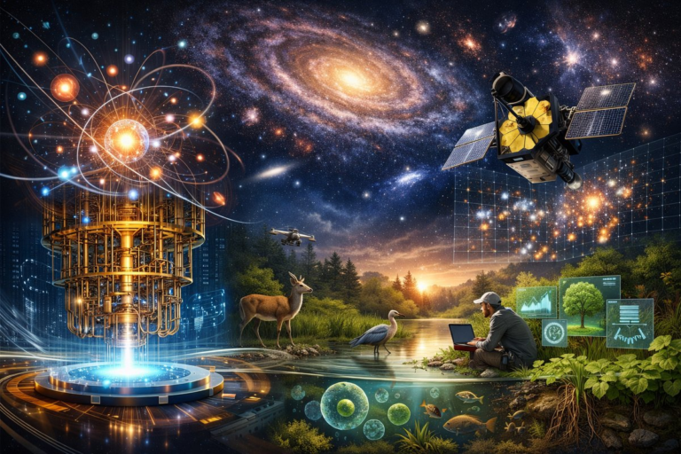
Beyond satellites and cameras, a new generation of quantum-tuned instruments is unveiling the subtle rhythms of our planet. From minute magnetic fluctuations in the soil to ghostly photon echoes above the canopy, these tools are rewiring our understanding of environments and cosmic connections.
In a remote corner of a temperate rainforest, researchers pause under the moss-draped canopy, eyes fixed on a small device humming at the edge of audibility. This instrument, harnessing principles of quantum physics, measures magnetic fields at sensitivities once thought impossible. It listens to the Earth’s own signals-tiny fluctuations generated by underground water movement, shifting soils, and even the migration of subterranean life. These quantum whispers, inaudible to classical sensors, hold clues to ecological resilience and geological change.
Traditional environmental monitoring has relied on satellites, drones, and ground stations to map landscapes and track variables such as temperature, moisture, and vegetation cover. While these methods deliver valuable data at broad scales, they often miss the fine-grained dynamics where ecosystems actually respond to stressors. The blink between tree roots exhaling carbon dioxide or the faint shift in mineral composition deep underground can escape conventional tools. Today’s challenge is to bridge that gap, to capture both the atomic-scale signals and the planetary patterns they aggregate into.
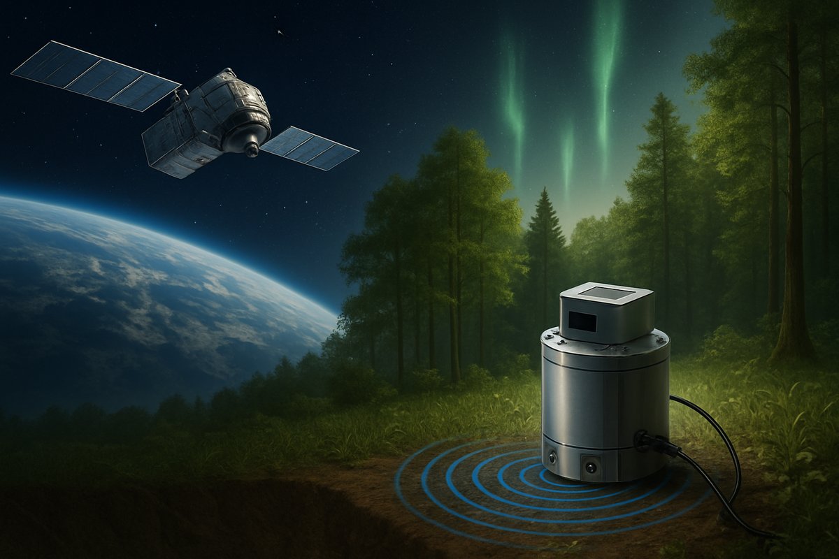
Enter quantum sensors: devices that exploit the quirks of quantum mechanics-entanglement, superposition, and quantum tunneling-to achieve unparalleled precision. Atomic magnetometers, for example, use clouds of vaporized atoms whose spin aligns with ambient magnetic fields. When minute changes occur, the spins wobble ever so slightly, and lasers read out those wobbles as data about the surrounding environment. Quantum gravimeters leverage atom interferometry to detect minuscule variations in gravitational pull, revealing subsurface density anomalies that hint at water tables or mineral deposits. These instruments are no longer confined to lab benches; they’re ruggedized for field deployment on backpack frames and unmanned aerial platforms.
Magnetometers once weighed hundreds of pounds and required cryogenic cooling to keep superconducting coils functioning. Today’s quantum magnetometers fit into shoebox-sized housings and operate at room temperature, achieving sensitivity in the femtotesla range-orders of magnitude beyond earlier models. Field teams carry them like binoculars, scanning the ground in systematic transects. In one study, researchers mapped the magnetic imprint of buried river channels beneath a floodplain, detecting ancient tributaries that influence modern groundwater flow. These findings refine water resource management, guiding restoration projects and informing local communities about hidden aquifers.
At the same time, airborne lidar scanners have become powerful allies in decoding canopy structure and topography. Laser pulses shot from drones or aircraft bounce off leaves, branches, and the forest floor, returning as time-stamped echoes. By stitching millions of these echoes together, a three-dimensional map emerges, layer by layer. When quantum tuning is applied-using single-photon detectors cooled to low temperatures-signal quality soars. Researchers can now distinguish between overlapping pulses at nanosecond scales, resolving subcentimeter details in the densest foliage. This precision reveals how carbon moves through forest layers, where decay hotspots concentrate, and which microhabitats harbor rare species.
Portable spectrometers complement magnetometers and lidar by analyzing the spectral fingerprint of materials. Miniaturized Raman spectrometers, for instance, use laser light to excite molecules and read their vibrational patterns. In the field, teams scan leaves to measure photosynthetic efficiency or assess soil compositions for nutrient content. When deployed alongside quantum gravimeters, these spectrometers help paint a multi-dimensional portrait: gravitational anomalies suggest voids or aquifers, spectral signatures identify mineral-rich strata, and magnetic data reveal geological structures. Together, they guide precise sampling, reducing wasteful drilling and minimizing disturbance to sensitive ecosystems.
On a recent expedition to a mountain watershed, a collaborative team of physicists and ecologists combined quantum magnetometry, entangled-photon lidar, and handheld spectrometry. They mapped hidden limestone channels that shape subterranean rivers, then measured the respiration rates of moss communities overhead. The resulting dataset was staggering in resolution: scientists could track carbon fluxes in microhabitats barely a few square centimeters in size, then extrapolate to understand watershed-scale dynamics. This dynamic interplay of fieldwork and quantum instrumentation demonstrated that ecological patterns emerge not only from macroclimate but from minute electromagnetic and molecular interactions.
Back in the lab, raw quantum sensor readings-time series of magnetic noise, gravimetric fluctuations, and photon arrival times-undergo sophisticated processing. Machine learning models trained on synthetic data help classify signal sources, distinguishing between insect swarms, root growth, and human foot traffic. Researchers then integrate these refined signals into climate models, enhancing predictions of carbon sequestration rates and flood risks. Early results suggest that incorporating quantum-derived measurements can tighten uncertainty bounds by up to 30 percent compared to traditional remote sensing alone.
In parallel, climate modelers are exploring how near-surface quantum data can calibrate satellite observations. Atomic clocks flown on low-orbit platforms already test general relativity by detecting time dilation in Earth’s gravitational field. By fusing these orbital measurements with ground-based quantum gravimeters, scientists refine maps of Earth’s geoid-the irregular shape influenced by mass distribution. Improved geoid models enhance ocean circulation forecasts, which in turn inform weather predictions and sea-level rise projections.
This convergence of quantum sensing and cosmic perspective illustrates a profound shift: science is no longer bound by scale. Instruments can sense the subatomic dance of particles and link those measurements to planetary phenomena. In practice, this means a single network of quantum-enabled sensors could monitor seismic precursors, track groundwater changes, and update climate models in near-real time. By standing at the crossroads of the quantum and the cosmic, researchers can explore questions that once felt like philosophical speculation.
Yet the proliferation of ultra-sensitive sensors raises ethical and privacy considerations. Airborne lidar and magnetometry can reveal hidden structures-archeological sites, private pipelines, or clandestine tunnels-without consent. Communities living on ancestral lands may find their cultural heritage exposed or disrupted by data collection. Establishing guidelines for data ownership, access controls, and informed consent is critical. Researchers are collaborating with ethicists, local stakeholders, and policymakers to draft protocols that respect sovereignty, protect sensitive information, and ensure transparent governance.
Engagement with local communities has proven essential. In one watershed study, indigenous stewards contributed traditional knowledge of seasonal water flows, identifying sacred springs and ecologically critical zones. Quantum sensor data, when interpreted in dialogue with this first-hand expertise, yielded insights that neither approach could achieve alone. The partnership fostered mutual trust: community representatives gained access to data visualization tools, while scientists developed deeper empathy for cultural values and land stewardship practices.
Looking ahead, the next frontier lies in networked quantum sensor arrays-distributed nodes communicating via encrypted optical links. Picture hundreds of compact gravimeters and magnetometers embedded in forest soil, seafloor buoys equipped with entangled-photon transceivers, and airborne drones that swap data midflight. This distributed intelligence will generate dynamic, high-resolution maps of environmental change as it unfolds. Early warning systems for earthquakes, landslides, or toxic algal blooms could operate at scales small enough to safeguard remote villages and large enough to inform regional policy.
As quantum sensors become more affordable and energy-efficient, they will intersect with citizen science. Educational kits could empower students to monitor groundwater or measure urban magnetic anomalies, fostering curiosity and data literacy. Amateur naturalists equipped with handheld lidar scanners might map invasive species in local parks, contributing to conservation efforts. The democratization of precision measurement invites a new era of participatory science, where discovery is not confined to ivory towers but shared across communities.
In this evolving landscape, the true marvel is the unity of scales-from quanta flickering in atomic spin states to cosmic ripples traced by satellite clocks. The same quantum principles that guide next-generation sensors are at work in distant stars and black holes. By harnessing them here on Earth, we not only deepen our understanding of local ecosystems but also sharpen our lens on the universe. The boundaries between the quantum and the cosmic dissolve, revealing a world woven together by patterns of astonishing subtlety and grandeur. Now is the moment to listen closely-to those quantum whispers and cosmic echoes-and to discover what stories they share about our planet and beyond.