Location
Mount Vernon, WA 98274

Location
Mount Vernon, WA 98274
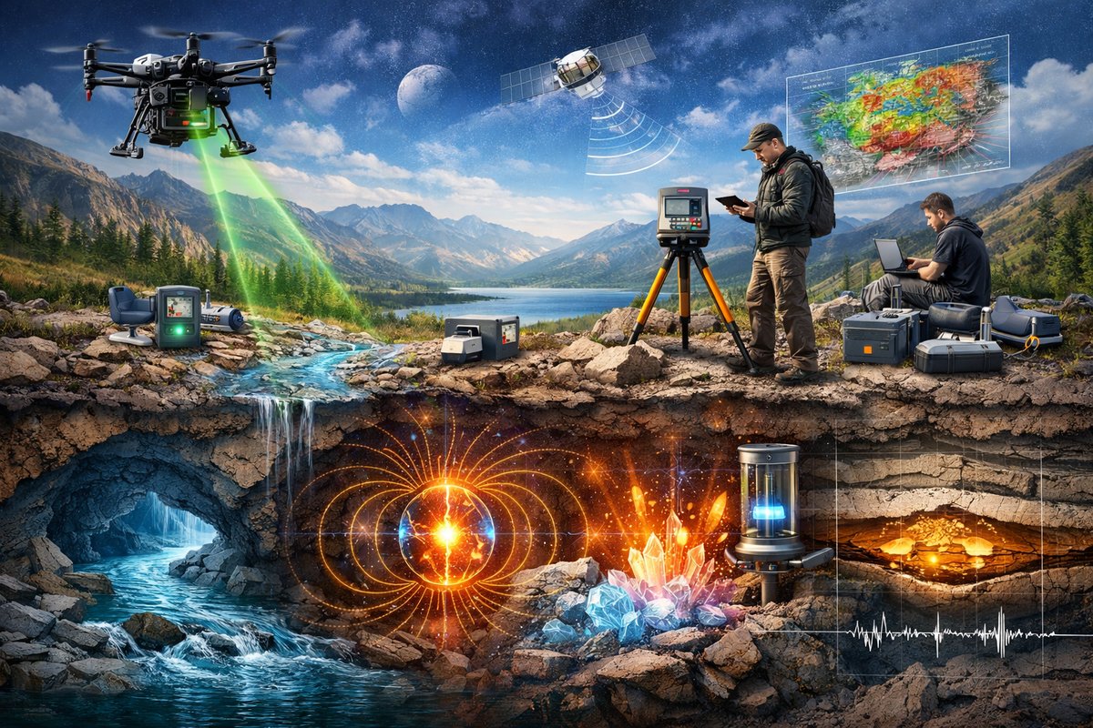
From precision gravimeters to sensor-equipped drones, researchers are combining age-old curiosity with cutting-edge tools to decode Earth's invisible patterns. Multi-sensor arrays and citizen-science platforms are revealing subterranean waterways, magnetic anomalies, and quantum quirks in rocks, promising fresh insights into natural hazards, resource mapping, and the planet's hidden choreography.
Every day, unseen forces ripple through the ground beneath our feet, shape the air around us, and even tingle across our skin. Gravity anchors us to the planet, magnetic fields steer compasses and shield life from solar storms, while quantum interactions in minerals quietly influence conductivity deep in Earth’s crust. Until recently, these phenomena have remained largely veiled. Now, an emerging generation of instruments and interdisciplinary collaborations is turning the invisible into data that scientists can visualize, analyze, and share around the world.
At the heart of this revolution stands gravity mapping. Building on decades-old principles, satellite missions like the gravity recovery experiments have tracked subtle changes in Earth’s mass distribution, revealing the ebb and flow of oceans, shifts in ice sheets, and seasonal groundwater variations. On the ground, superconducting and spring-based gravimeters have grown more compact and precise, capable of detecting minute fluctuations caused by passing vehicles or even distant earthquakes. Field teams are deploying networks of these instruments to create high-resolution gravity maps that lay bare the subterranean topography of aquifers and mineral deposits.
One striking application involves monitoring volcanic systems. By measuring gravity changes over time, researchers infer the movement of magma chambers and assess eruption risk. When heavy magma rises, it momentarily increases local gravitational pull; when it recedes or cools, the pull diminishes. Paired with seismic readings, gravity data can sharpen forecasts of volcanic activity, giving nearby communities critical early warning.
Meanwhile, magnetism is revealing secrets of Earth’s interior and its tectonic past. Advances in superconducting quantum interference devices, or SQUID magnetometers, have enabled detection of magnetic anomalies with unmatched sensitivity. Oceanographers tow these instruments behind research vessels, mapping variations along mid-ocean ridges that record seafloor spreading rates and polarity reversals over millions of years. On land, portable magnetometer arrays help archaeologists uncover buried structures by spotting subtle shifts in the local magnetic field caused by ancient walls or kilns.
High-altitude aerial surveys are amplifying those insights. Unmanned drones, equipped with lightweight magnetometers, fly systematic grids over landscapes remote or inaccessible to ground crews. They reveal hidden faults, buried volcanic vents, and even metallic ore bodies. By stitching together magnetism, gravity, and topographic data, scientists build multidimensional models that once required massive, ship-borne equipment or costly helicopter campaigns.
Yet the story of Earth’s hidden forces isn’t confined to gravity and magnetism alone. Fluid dynamics plays a starring role in phenomena ranging from ocean currents to mantle convection. In laboratory tanks, researchers visualize emergent patterns-like Rayleigh-Bénard convection cells-by heating fluids from below and tracking dye movements. These experiments serve as scaled-down analogues of the churning currents that carry heat out of Earth’s core. When coupled with numerical simulation, they help refine our understanding of how planets cool, how plate tectonics sustain themselves, and how atmospheric vortices form on gas giants.
Quantum-level quirks are also stepping into the spotlight. In certain rock minerals, electrons tunnel between atoms, subtly altering electrical conductivity and affecting how seismic waves propagate. Newly designed quantum sensors-based on diamond defects or atom interferometry-are so sensitive that they can pick up these minute effects in field settings. By measuring quantum signatures in crustal rocks, researchers are exploring possibilities for more accurate mineral exploration and even novel earthquake forecasting techniques.
The magic truly happens when these diverse data streams converge. Teams are developing integrated sensor platforms that record gravity, magnetism, seismic vibrations, and atmospheric parameters simultaneously. Advanced machine-learning algorithms then sift through terabytes of data, uncovering patterns human analysts might miss. In certain pilot studies, this fusion of measurements has pinpointed previously unknown groundwater channels and refined estimates of volcanic magma volumes with remarkable accuracy.
Citizen scientists are joining the effort thanks to DIY hardware innovations. Low-cost sensor modules for single-board computers allow enthusiasts and students to build their own magnetometers, gravimeters, or tilt meters. Shared open-source firmware and cloud-based dashboards mean that volunteers from rural communities to urban rooftops can upload field readings that enrich global datasets. This democratization of data is speeding discoveries and helping communities better prepare for natural hazards.
Environmental data loggers have likewise become essential tools in both professional and public hands. Compact devices recording temperature, humidity, barometric pressure, and air composition can now operate for months on a single battery. Researchers deploy them in boreholes, forest canopies, and coastal wetlands to track changes that link to subsurface fluid movement and mass redistribution. These records feed back into gravity model corrections, boosting the fidelity of large-scale satellite gravity maps.
On the aerial front, consumer-grade quadcopter kits have graduated to professional platforms capable of flying programmed survey routes with centimeter-level GPS accuracy. Equipped with payload bays, they can host magnetometers, hyperspectral cameras, and even ground-penetrating radar units. This versatility is transforming how geoscientists map archaeological sites, assess landslide risk, or scout remote volcanic fields. Small, affordable drones are closing the gap between expensive airborne missions and slow, labor-intensive ground surveys.
Back in the lab or classroom, fluid dynamics experiment kits are making sophisticated demonstrations accessible. Transparent tanks, variable-speed stirrers, and fluorescence dyes let students and researchers observe turbulence, wave formation, and buoyancy-driven flows in real time. By experimenting with different fluid viscosities and heating profiles, users gain intuitive insight into planetary processes that otherwise seem abstract when described only in equations.
When researchers combine satellite observations, airborne surveys, ground sensors, and laboratory controls, the result is an unprecedented level of detail in mapping Earth’s hidden structures. In one recent study, teams fused gravity data with drone-borne magnetics to locate a deep subterranean channel carrying groundwater beneath a desert region. This finding guided sustainable water-management plans for communities facing chronic shortages, demonstrating how an orchestra of technologies can yield actionable insights.
These breakthroughs carry broad implications. Enhanced hazard forecasting can better prepare cities for earthquakes, landslides, or volcanic eruptions. Improved resource mapping helps guide responsible mining and groundwater extraction, reducing environmental impact. And refined climate models benefit from a clearer picture of mass shifts in ice sheets and aquifers, contributing to more accurate sea-level rise projections.
Collaboration remains the key theme. International research consortia, open-data portals, and transdisciplinary workshops are breaking down silos between physicists, geologists, computer scientists, and citizen volunteers. Together, they are charting a path toward a planet where the once-invisible forces become aids rather than adversaries in our quest for sustainability, resilience, and wonder.
As we stand on the threshold of a new era in Earth science, nature’s choreography grows ever more vivid. With gravity maps unfolding beneath our feet and magnetic tapestries draped across the sky, the hidden forces that shape our world are finally stepping into the light. For curious minds and aspiring scientists alike, the invitation is clear: pick up a sensor, join a data network, or simply look closer at the ground beneath you. You may be surprised by the subtle currents and quantum whispers waiting to be heard.












