Location
Mount Vernon, WA 98274

Location
Mount Vernon, WA 98274
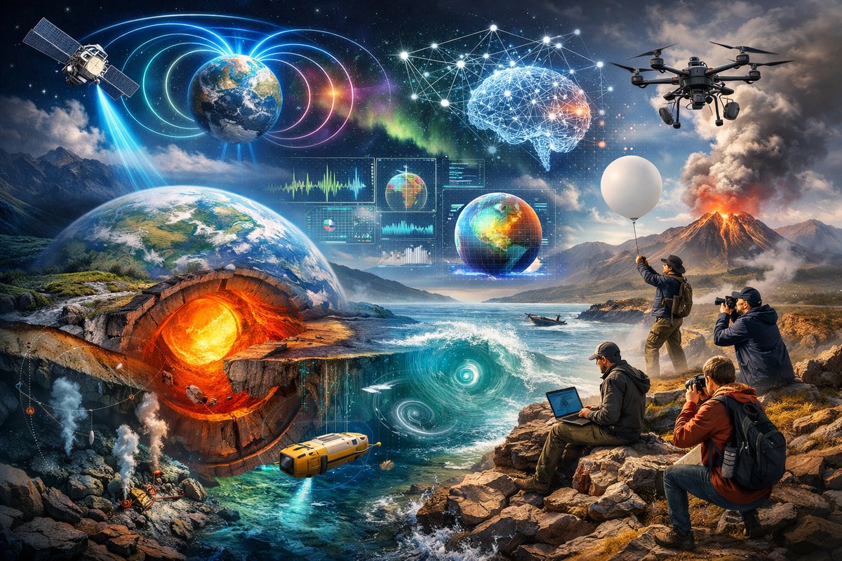
A groundbreaking interdisciplinary effort is charting the intricate tapestry of gravity, magnetism, emergent systems, and quantum surprises that underlie our planet's dynamics. Combining cutting-edge sensors, AI-driven analysis, and citizen science, researchers are revealing hidden patterns-from deep-sea plate motions to atmospheric eddies-ushering in a new era of environmental understanding and hazard prediction.
A new wave of geoscience research is peeling back the layers of Earth’s natural forces to reveal a dynamic interplay of gravity, magnetism, emergent systems, and quantum-scale phenomena. Rather than treating these forces as isolated curiosities, multidisciplinary teams are now fusing data from gravity meters, magnetometers, autonomous drones, quantum sensors, and advanced modeling techniques. The result is a holistic portrait of our planet’s invisible currents-one that promises more accurate hazard forecasts, smarter resource management, and a deeper sense of wonder about the forces that shape our world.
At the forefront of this movement are portable gravimeters that students and researchers can carry into the field. These instruments leverage atom-interferometry principles to detect minuscule changes in gravitational acceleration, tracking subtle mass redistributions beneath the surface. Scientists have deployed networks of these gravimeters across fault zones, volcanic regions, and aquifers to monitor shifts in underground mass. By comparing gravity readings over time, they can identify rising magma chambers long before an eruption or detect groundwater withdrawals that might trigger land subsidence. The portability and sensitivity of modern gravimetry are transforming what was once a specialist’s tool into a staple of environmental monitoring.
Magnetic surveying techniques have also entered a renaissance. Advances in fluxgate magnetometers, anisotropic magnetoresistive sensors, and magnetotelluric stations are enabling high-resolution maps of local magnetic anomalies. In coastal regions, drones equipped with lightweight magnetometer payloads hover over shorelines to trace hidden shipwrecks, submerged pipelines, and basalt outcrops. Inland, networks of stationary sensors record geomagnetic fluctuations caused by solar storms and ionospheric currents, feeding real-time data into space weather models. By integrating aerial, surface, and subsurface magnetic measurements, researchers are discovering connections between deep-seated mineral structures and surface magnetic field distortions.
Beyond classical forces, investigators are exploring emergent patterns that arise from countless interactions among organisms, fluids, and rock formations. From the spiral phyllotaxis of plants to the branching networks of river deltas, emergent systems obey simple rules even as they produce complex behaviors. Biologists armed with aerial imaging and LIDAR scan forest canopies to decode how tree spacing influences wind-driven nutrient flows. Ecologists track flocking starlings and schooling fish to understand how local alignment rules scale up into breathtaking aerial or underwater formations. These insights into emergence are informing the design of resilient infrastructure-such as self-organizing sensor networks that mimic ant colonies to maintain communication even when individual nodes fail.
In laboratories around the world, quantum sensors are taking natural force detection to the next level. Superconducting quantum interference devices (SQUIDs) can pick up the faintest magnetic fields-down to femtotesla levels-shedding light on processes deep within Earth’s core. Quantum tunneling detectors measure minuscule pressure waves generated by distant earthquakes, while nitrogen-vacancy center probes in diamond can sense electric fields with nanometer-scale resolution. By embedding quantum sensors in boreholes and undersea observatories, scientists are beginning to listen directly to the whisper of tectonic plates shifting, volcanic gases bubbling, and ocean currents swirling.
All of these sensing modalities produce massive quantities of data, and artificial intelligence is the glue that binds them together. Machine learning algorithms trained on historical gravity, magnetic, seismic, and electromagnetic datasets can now flag anomalies that human analysts would overlook. Unsupervised learning techniques cluster emergent behavior patterns in vegetation growth or animal movement, revealing ecological tipping points. Data assimilation platforms ingest real-time feeds from global sensor arrays, continually updating predictive models for landslides, volcanic eruptions, and geomagnetic storms. The synergy between sensor technologies and AI-driven analysis is transforming Earth system science into a proactive discipline rather than a reactive one.
Citizen science initiatives are bridging the gap between professional research and public engagement. Amateur enthusiasts equipped with smartphone accelerometers and do-it-yourself magnetometer kits contribute to distributed networks that provide high-density coverage of gravity and magnetic readings. Online platforms allow participants to upload their measurements, visualize local anomalies, and compare results with professional surveys. This crowdsourced approach not only enhances data resolution but also fosters a broader appreciation for the invisible forces at work beneath our feet and around our homes.
One striking success story comes from a collaborative expedition to map seafloor magnetism along a mid-ocean ridge. Researchers deployed a fleet of autonomous underwater vehicles, each carrying high-precision magnetometers and temperature sensors. Over the course of several months, the AUVs traced the undulations of newly forming basalt as it cooled and recorded the magnetic stripes that reveal the history of plate tectonics. When the data were analyzed, an unexpected magnetic reversal pattern emerged-indicating a previously undocumented brief inversion of Earth’s magnetic field half a million years ago. This discovery has profound implications for understanding the timing and drivers of geomagnetic flips and for refining models of core dynamics.
In volcanic regions, teams have begun combining gravity and magnetic surveys with gas composition analysis and thermal imaging. At an active volcano, portable gravimeters detect magma chamber inflation; magnetometers pick up thermal demagnetization signals in cooling lava; and multi-gas sensors measure the ratios of sulfur dioxide, carbon dioxide, and hydrogen sulfide in fumaroles. By correlating these different fingerprints, volcanologists can construct a three-dimensional, real-time view of subterranean magma movements. This multidata approach has already led to more accurate eruption forecasts and early-warning alerts for nearby communities.
Beyond hazard monitoring, decoding natural forces opens doors to sustainable resource management. Gravity surveys pinpoint dense ore bodies and freshwater aquifers, offering a low-impact way to explore critical resources. Magnetic mapping helps identify geothermal reservoirs buried beneath sedimentary basins, guiding the placement of wells for renewable energy extraction. Emergent system analysis informs reforestation projects by predicting how tree arrangements will influence microclimates and carbon sequestration. Quantum sensors reveal groundwater salinity gradients and contamination plumes at unprecedented resolution, supporting targeted remediation efforts.
The implications for environmental stewardship and public safety are immense. By weaving together gravity, magnetism, emergence, and quantum-level observations, the next generation of Earth monitoring systems will be more robust, adaptive, and inclusive. The invisible threads that once eluded detection are becoming part of a living tapestry that scientists, policymakers, and citizens can read in real time. This integrated approach promises not only to protect lives and ecosystems but also to ignite a fresh wave of curiosity about the forces that sculpt our planet.
As sensor technologies continue to miniaturize and computational power grows, the boundary between research stations and everyday life will blur. Home weather stations might one day include compact gravimeters; educational kits could let students measure magnetic anomalies in their backyards; smartphone apps may tap quantum sensors to track local disturbances. The invisible forces that shape the world-from the pull of gravity to the subtlest quantum flicker-are poised to enter the collective human consciousness.
We stand at the threshold of a new era in Earth science. By decoding the invisible patterns that underlie our planet, we gain the power to anticipate hazards, steward resources wisely, and deepen our connection to the natural world. In doing so, we transform what was once hidden into a shared source of wonder, inspiration, and responsibility. The threads that bind gravity, magnetism, emergence, and quantum phenomena are now within our grasp-and with them comes the promise of a more informed and harmonious relationship with the Earth.












