Location
Mount Vernon, WA 98274

Location
Mount Vernon, WA 98274
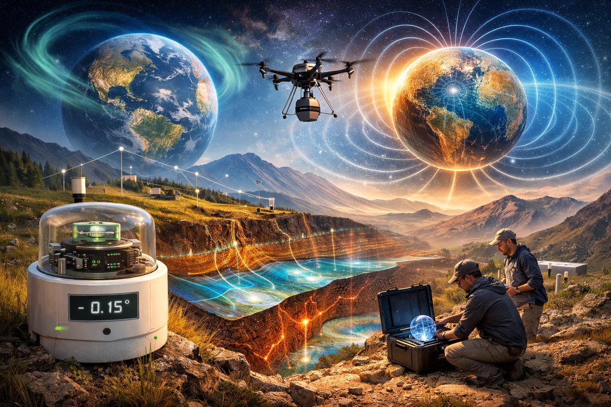
A newly launched global network of volunteer-run sensors is decoding Earth's subtle magnetic and gravitational rhythms. By combining backyard tiltmeters, drone-mounted magnetometers and quantum sensor prototypes, researchers are revealing emergent geophysical patterns that could revolutionize water resource mapping and earthquake forecasting.
Across backyards, mountain trails and coastal shores, citizen scientists are quietly deploying an array of compact sensors to eavesdrop on Earth’s most elusive conversations. What began as a handful of hobbyists tinkering with magnetic compasses and tiltmeters has blossomed into an interconnected web of more than ten thousand sensing nodes worldwide. From dense urban rooftops to remote desert plateaus, each device contributes a single thread to a planetary tapestry of gravity fluctuations, magnetic murmurs and emergent environmental signals.
In the arid expanses of the American Southwest, a swarm of lightweight drones carries three-axis magnetometer modules above shifting dune fields. As sand avalanches and underground aquifers interact, the drones record minute variations in the local magnetic field. Those readings, streamed in real time to a cloud database, reveal previously hidden channels of subsurface water. Hydrologists collaborating with the network have already identified three new shallow aquifers in regions once thought bone-dry, demonstrating the power of magnetic mapping beyond mineral exploration.
Not far away, along a windswept coastline, volunteers have implanted precision tiltmeters in steel rods sunk beneath the sand. These devices measure infinitesimal changes in gravitational pull caused by tidal movements and atmospheric pressure shifts. By stitching together tilt data from hundreds of sites, geophysicists can visualize gravity waves traversing the Earth’s crust-waves so gentle they were once drowned out by ambient noise. Now those waves form the basis of a real-time gravitational atlas, continuously updated by participants on every continent.
Individually, magnetic and gravitational measurements offer tantalizing glimpses into subsurface dynamics. But the true breakthrough emerged when researchers began fusing the two data streams using advanced analytics. Clustered sensor arrays reveal emergent patterns-synchronized oscillations in gravity and magnetism that trace the flow of molten materials deep within the mantle. Such patterns had been theorized but never observed outside laboratory conditions. They appear as ghostly ribbons of energy, dancing through tectonic plates long before earthquakes unfold.
Pushing the envelope further, a team of physicists has begun testing diamond-based quantum magnetometers on high-altitude balloons. These sensors exploit the quantum properties of nitrogen-vacancy centers in diamond to detect magnetic variations millions of times fainter than Earth’s ambient field. Suspended in the stratosphere, they scan vast swathes of land below, complementing ground-level readings with a bird’s-eye view of the planet’s magnetic mosaic. Early results hint at bands of anomalous magnetism stretching edge to edge across continents-potential fingerprints of deep-seated mineral structures and ancient tectonic boundaries.
Back on terra firma, machine learning algorithms sift through terabytes of sensor data each day, teasing out correlations imperceptible to the human eye. Neural networks trained on seismic, magnetic and gravitational inputs flag anomalies in real time, alerting researchers to potential shifts in groundwater flow, volcanic activity or stress accumulations along fault lines. This emergent-systems approach transforms a scattered collection of devices into a responsive organism, capable of detecting Earth’s subtle shifts long before traditional monitoring stations pick up tremors.
Already, the network has captured an unexpected phenomenon: micro-gravity pulses triggered by seasonal currents in the Southern Ocean. As colossal masses of water surge beneath Antarctic ice shelves, they induce gravity waves that propagate through the solid Earth. Thousands of citizen-deployed tiltmeters half a world away registered the effect, allowing scientists to map ocean circulation patterns with unprecedented precision. The discovery promises new insights into climate-driven changes in polar regions, far beyond the reach of conventional marine surveys.
Parallel efforts in magnetic monitoring have uncovered filament-like structures-zones of intensified magnetic flux-snaking beneath volcanic islands in the Pacific. These filaments align with subterranean magma conduits and hydrothermal vents, offering a novel method for predicting volcanic unrest. Volunteers on nearby shorelines have reported subtle compass deviations hours before minor tremors, a phenomenon now under systematic investigation by volcanologists eager to enhance early warning systems.
Applications for water managers, urban planners and disaster-preparedness agencies are already coalescing. In drought-prone regions, magnetic mapping allows efficient drilling for fresh water, reducing economic and environmental costs. Coastal cities can integrate real-time gravity data into subsidence models, safeguarding critical infrastructure from unseen sinks and slides. And seismologists view the emergent patterns as a potential game-changer in forecasting earthquakes, transforming formerly static hazard maps into living, breathing risk landscapes.
The heart of this revolution is accessibility. All required instrumentation can be assembled from off-the-shelf components-compact magnetometers, precision accelerometers, microcontrollers and solar panels. Hobbyist forums buzz with firmware tweaks and data-visualization hacks. Educational institutions, from community colleges to remote boarding schools, have joined in, using the network as a hands-on classroom for teaching physics, earth science and data analytics.
Yet challenges remain. Remote sensors require reliable power sources in sunless canyons and polar winters. Data integrity depends on fault-tolerant communication protocols that can coexist with patchy internet connectivity. Ensuring consistent calibration across thousands of homemade devices demands rigorous quality-control procedures. Collaborative teams are tackling these hurdles with open-source hardware designs, energy-harvesting experiments and distributed ledger technologies for secure, verifiable data logging.
Looking ahead, the community plans to expand beneath the waves. Autonomous underwater gliders equipped with both gravimeters and magnetometers will patrol continental shelves, linking oceanic signals with terrestrial observations. There are proposals to loft quantum tilt sensors on near-space rockets, extending the reach of gravitational monitoring to the edges of the stratosphere. Combined, these initiatives promise a holistic view of Earth’s hidden forces-gravity, magnetism and beyond-captured in unprecedented detail.
Beneath the surface of ordinary landscapes, nature performs a ceaseless ballet of forces. Gravity ebbs and flows with tides and temperature, magnetism weaves through mineral veins and molten flows, and quantum quirks flicker at the boundaries of measurement. Thanks to a growing network of volunteers armed with modest equipment and boundless curiosity, we are finally learning to listen. And in that communion, we glimpse a world more interconnected-and more alive-than ever imagined.












