Location
Mount Vernon, WA 98274

Location
Mount Vernon, WA 98274
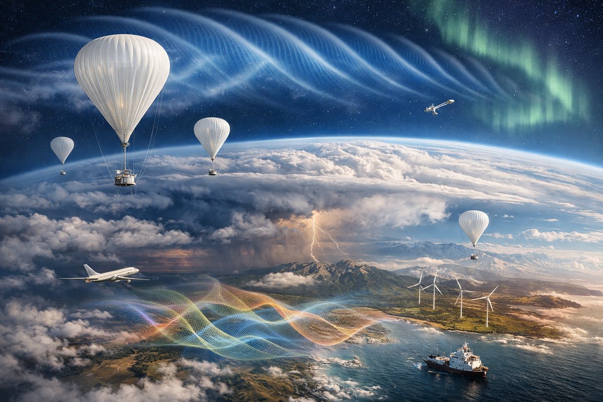
An international fleet of high-altitude balloons has mapped elusive gravity waves rippling through the lower atmosphere, revealing how these invisible oscillations shape weather, influence aviation, and couple with Earth's magnetic envelope. This unprecedented dataset offers fresh insights into storm genesis, renewable energy optimization, and climate modeling.
A network of more than fifty instrumented balloons launched from six continents has for the first time provided a high-resolution, global view of atmospheric gravity waves in the troposphere and lower stratosphere. Over a six-month period, the fleet recorded pressure, temperature, and density fluctuations at altitudes between 10 and 30 kilometers, revealing coherent wave packets radiating from mountain ranges, storm systems, and coastal wind shears.
Gravity waves in the atmosphere are oscillations generated when displaced air parcels attempt to return to equilibrium under the restoring force of gravity. Though often invisible to the naked eye, these waves can appear as rippled cloud streets towering over mountain crests or as subtle undulations in temperature profiles. Until now, researchers relied on sparse radiosonde launches and satellite limb sounding to study large-scale patterns. The balloon armada-deployed under a coordinated campaign by an international consortium-fills critical observational gaps in both space and time.
Instrument packages on each balloon include a high-spectral-resolution barometric sensor capable of detecting pressure changes as small as ten pascals, microthermal probes that register temperature shifts to within 0.01°C, and tri-axis accelerometers logging inertial forces linked to wave-induced vertical motions. Balloons transmit data every ten seconds via low-latency radio relay, allowing ground teams to assemble near real-time wave amplitude and phase maps.
Early findings show remarkably strong gravity waves forming within the lee of the Andes and the Southern Alps, propagating thousands of kilometers across the Pacific. In one case, wave amplitudes exceeded 300 meters in vertical displacement at 15 kilometers altitude. Such robust signals underscore the role of mountain-launched waves in energy transfer between atmospheric layers.
Equally striking are gravity waves born from deep convective storms over equatorial oceans. Balloon sensors detected wave trains radiating outward from thunderstorm complexes, carrying momentum upward and modulating the jet stream. Modelers are already integrating these observations into next-generation forecast systems to improve tropical cyclone track predictions and anticipate sudden stratospheric warming events.
The survey also captured the coupling between gravity waves and the ionospheric E-region’s electric currents. Fluctuating neutral densities induced by the waves produce localized conductivity variations, subtly modulating the flow of charged particles in Earth’s magnetic field. Though the magnetic signatures are minuscule-measured in picoteslas-they may influence radio propagation and high-frequency communications over midlatitude regions.
Beyond pure science, the project has practical implications for aviation safety. Wave-driven turbulence pockets at flight levels can catch even modern airliners off guard. By mapping the global distribution of gravity wave hotspots, airlines may one day adjust flight routes or altitudes to avoid sudden buffer-loss events. The balloon dataset has already informed a pilot study with two commercial carriers testing wave forecasts in the North Atlantic corridor.
Wind-energy developers are also watching closely. Gravity waves interact with large wind turbine arrays by inducing small yet persistent vertical wind shear that affects power output and blade fatigue. Preliminary analyses suggest that turbines downwind of major mountain chains could see a 2-5% variation in expected output due to wave-induced winds. Integrating wave forecasts into turbine control systems holds promise for smoothing power delivery to the grid.
The success of the balloon fleet hinges on advances in miniaturized sensor technology and smart autonomy. Each platform flies for up to 100 hours, adjusting buoyancy to sample different altitude layers before safely descending under parafoil for recovery. Onboard algorithms detect wave signatures in live data, triggering fine-tuned altitude adjustments to capture crest and trough phases with maximum resolution.
“This is the most detailed gravity wave survey our community has ever seen,” says one atmospheric physicist involved in the analysis. “We’re uncovering patterns we didn’t even know existed, from coastal wave trains that morph with daily sea breezes to high-latitude waves excited by auroral electrojets.” The ability to correlate these waves with magnetospheric activity opens new interdisciplinary research frontiers at the boundary of atmospheric physics, space weather, and environmental monitoring.
Data from the balloon network are publicly available through an open-access repository. Early adopters include climate modelers testing the impact of unresolved gravity wave drag on long-term simulations and aerospace engineers aiming to design more resilient navigation systems. Graduate students worldwide are already downloading wave spectra datasets for thesis projects exploring turbulence interaction and wave-mean flow coupling.
Looking ahead, project leaders plan to expand the armada into polar regions, where gravity waves play a critical role in wintertime ozone chemistry and polar vortex dynamics. Equatorial launches will continue, focusing on the maritime continent-a region notorious for complex wave patterns triggered by the interplay of land-sea breezes and deep convection.
Collaborations with satellite missions are also in the works. By combining balloon observations with limb-viewing infrared sounders and global navigation satellite system (GNSS) radio occultation profiles, scientists hope to build a seamless three-dimensional picture of gravity wave propagation-from ground sources to the mesosphere.
The balloon armada experiment demonstrates how modular, miniaturized sensor platforms can revolutionize environmental monitoring. From microgravity oscillations to magnetism-coupled perturbations, the invisible forces that shape our atmosphere are finally coming into focus. As the network grows and integrates with other observational systems, we stand at the threshold of predictive capabilities that could transform weather forecasting, climate science, and our understanding of Earth’s dynamic envelope. A new era of atmospheric exploration has begun-one where silent waves are no longer hidden but mapped, quantified, and woven into the tapestry of global environmental intelligence.












