Location
Mount Vernon, WA 98274

Location
Mount Vernon, WA 98274
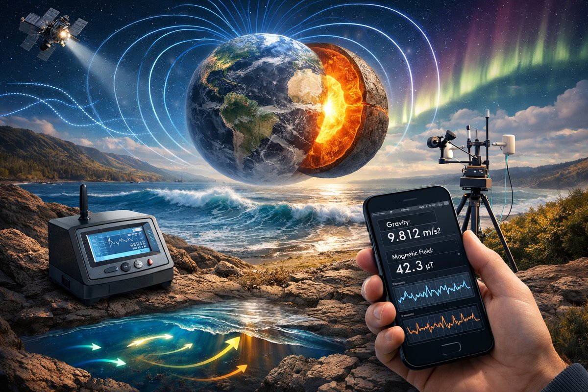
A newly launched citizen sensor network is combining off-the-shelf instruments and smartphone modules to measure minute variations in Earth's gravity and magnetic fields. Early results are already revealing unseen fluid flows, tidal gravity waves, and geomagnetic quirks that could reshape our understanding of planetary dynamics.
In a groundbreaking collaboration that spans six continents and dozens of nations, a grassroots coalition of volunteer scientists, engineers, educators, and hobbyists has begun to map the planet’s most elusive forces in unprecedented detail. Armed with smartphones, inexpensive inertial measurement units, and consumer-grade magnetometer modules, participants contribute a continuous stream of data that reveals subtle variations in gravity, hidden electromagnetic currents, and the faint hum of seismic microtremors.
For centuries, gravity and magnetism have guided navigators, shaped our understanding of planetary interiors, and fueled scientific revolutions. Yet the instruments needed to detect fine anomalies in these fields have traditionally been locked behind specialized laboratories, national observatories, or costly deep-sea vessels. The Citizen Force Mapping Network (CFMN) is changing that. By tapping low-cost sensors normally used in robotics, virtual reality headsets, and smartphone orientation systems, the project democratizes access to the whispers of nature and invites anyone with a curious mind to join the quest.
At the heart of CFMN is a fleet of compact sensor kits that integrate three key measurements: gravitational acceleration, magnetic field strength, and inertial motion. Each kit contains a microelectromechanical system accelerometer and gyroscope, a 3-axis magnetometer, and a high-precision barometric pressure sensor. These modules plug directly into single-board computers or even into modern mobile devices via universal sensor ports. From the top of a mountain to the basement of an urban apartment, each node streams timestamped measurements into a decentralized data repository accessible to all contributors.
During the network’s first three months of operation, volunteers have logged more than half a million individual measurement sessions. Early analyses have already teased out fascinating patterns. In remote desert regions, gravimetric sensors have detected unexpected density variations suggesting large, buried aquifers feeding seasonal springs. Under river deltas and coastal wetlands, magnetometer readings reveal subtle electromagnetic anomalies that track shifting sediment and brackish water intrusion. In high-latitude zones, the network’s expanded coverage complements professional geomagnetic observatories, filling in gaps where official stations have long been sparse.
One of the most surprising discoveries emerged from a mid-ocean buoy outfitted with a similar sensor suite. Floating off the coast of a volcanic island chain, the buoy recorded rhythmic oscillations in local gravity every six hours. Researchers realized these tidal gravity waves correlated with deep-sea pressures and ocean floor flexing induced by lunar tides. The data fills a critical blind spot in global models of tidal loading and may improve forecasts of microseismic activity near underwater fault zones.
On land, small-scale deployments in urban basements and university dorms have unveiled their own hidden landscapes. By synchronizing many accelerometer-equipped nodes in a single building, contributors are mapping the propagation of structural vibrations caused by passing trains, distant construction, and even the daily rhythm of foot traffic. This emergent picture of a city’s microseismic fingerprint could one day inform urban planning, earthquake preparedness, and building design.
Meanwhile, the magnetic field measurements have shed new light on local anomalies tied to mineral deposits and subsurface structures. In regions with active mining operations, community scientists are detecting shifts in magnetic intensity that align with changes in subterranean stress and fluid movement. These insights may help prospectors and geotechnical engineers target new exploration sites or monitor the stability of mine shafts without intrusive drilling.
A key enabler of these breakthroughs is an open-source machine learning platform that ingests raw sensor streams and detects patterns across time and space. Contributors can annotate events-such as storms, nearby heavy machinery, or large gatherings-and teach the system to distinguish anthropogenic noise from Earth’s natural signals. As the dataset grows, the algorithms become more adept at isolating true geophysical phenomena, flagging anomalies that warrant deeper investigation.
Beyond gravity and magnetism, the network is beginning to experiment with integrating other subtle forces. Some pilot nodes are incorporating low-frequency electric field sensors to monitor natural electromagnetic pulses, while others deploy compact infrasound microphones to perceive the subaudible roar of volcanic vents, glaciers, and distant storms. Because all measurements share a unified timestamp and geolocation framework, researchers can correlate events across multiple domains and uncover complex couplings between forces that were previously studied in isolation.
The open infrastructure design encourages modular expansion. Anyone can propose a new sensor module-be it for barometric pressure, temperature gradients, or ambient radiation-and write a plug-in to merge its data into the collective stream. This extensible architecture has spurred creative side projects, such as using solar-charged motorized vehicles to patrol predetermined transects and map force gradients along highways and coastlines.
The real power of CFMN lies not just in the raw data, but in the community itself. Enthusiasts gather in local chapters to build sensor rigs, workshop analysis tools, and share anecdotes about odd readings and quirky field conditions. Educational institutions have adopted the network for hands-on science courses, giving students a chance to contribute real-world observations and to coauthor academic papers on emerging phenomena.
Looking ahead, the project plans to integrate next-generation quantum sensors that promise orders-of-magnitude higher sensitivity to gravity and magnetic fields. These compact quantum gravimeters and magnetometers operate at room temperature and could soon be as accessible as today’s smartphone sensors. When deployed within the citizen network, they will offer a glimpse of Earth’s hidden features at centimeter-scale resolution, from subterranean fault lines to buried cultural artifacts.
At the same time, researchers are exploring ways to use the network’s data for practical applications. By tracking fluid migration in aquifers, the initiative could inform sustainable water management in drought-prone regions. By mapping tidal gravity waves and ocean-floor flexing, it could improve tsunami and earthquake early-warning systems. By charting microseismic noise in cities, it could guide resilient urban design that mitigates the impact of vibrations on sensitive infrastructure.
In an era when large-scale scientific missions often require massive budgets and proprietary instruments, the Citizen Force Mapping Network offers a compelling alternative. It harnesses the collective curiosity, creativity, and ingenuity of thousands of volunteers and turns inexpensive consumer hardware into a planetary observatory. The echoes of Earth’s hidden forces are everywhere around us; we simply needed to listen with enough ears.
For those eager to join, the first step is acquiring a basic sensor kit, connecting it to a low-power data server or smartphone, and creating an online account with the project. From there, participants can choose a location-rooftop, paddock, coastal pier, or basement-and begin streaming data. The network’s open dashboard visualizes each node’s contribution, and community forums provide guidance on troubleshooting, calibration, and interpretation.
As the network continues to grow, every new sensor becomes part of a living tapestry of natural phenomena. Together, citizen scientists are weaving a high-resolution portrait of Earth’s subtle forces, revealing landscapes shaped not only by visible features but by invisible currents and gradients. In the coming years, the insights gleaned from this collective listening effort may transform fields as diverse as geology, oceanography, urban planning, and climate science. The hum of the planet has always been there; thanks to a global community of volunteers, we are finally tuning in with clarity and purpose.












