Location
Mount Vernon, WA 98274

Location
Mount Vernon, WA 98274
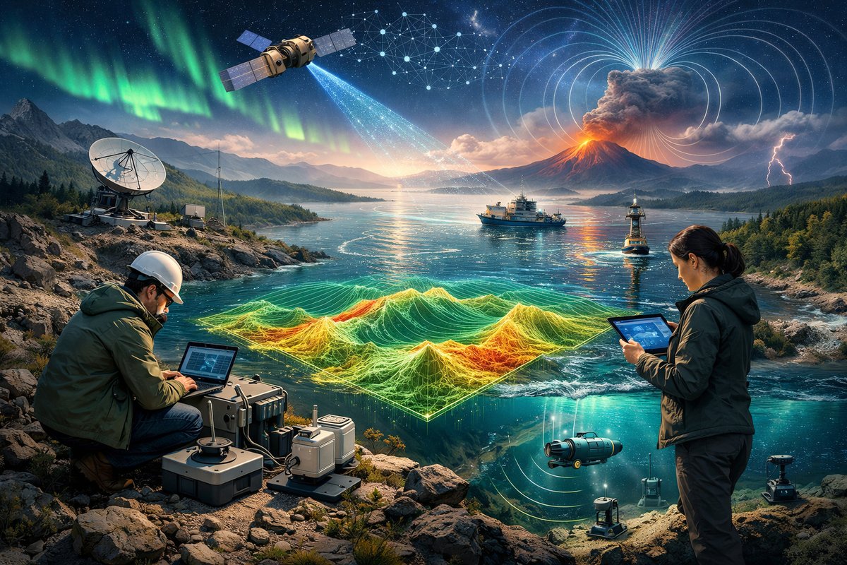
Scientists are deploying next-generation sensor arrays and AI-driven networks to map the planet's invisible forces-from ultrafine gravity shifts to shifting magnetic corridors-revealing emergent patterns across land, sea, and sky. This effort is reshaping our understanding of Earth's dynamic systems and hinting at novel applications in climate, resource management, and disaster prediction.
A convergence of quantum physics, advanced sensors, and machine learning is giving researchers an unprecedented window into nature’s hidden scaffolding. In remote volcanic craters, coastal reefs, and high-altitude airspace, teams are now gathering data on gravity anomalies, magnetic flux variations, and emergent currents in real time. What emerges is not just a richer map of invisible phenomena but an evolving portrait of how interconnected forces shape weather, ecosystems, and even human activity.
In the shadow of a dormant volcano in Iceland, a network of portable quantum gravimeters has captured minute shifts in subsurface density that precede magma movement by days rather than weeks. Traditionally, gravity surveys relied on bulky spring gravimeters, but recent breakthroughs in cold-atom interferometry have produced instruments that fit in a backpack and deliver sensitivity down to a few microgals. Over six weeks of continuous monitoring, researchers detected a gradual 3-microgal uptick beneath the crater floor-correlating with subtle ground tilt measured by tiltmeters and early seismic tremors. This advance not only sharpens eruption forecasts but points to broader geohazard applications, such as groundwater depletion and landslide risk assessment.
Meanwhile, above the ocean surface, a coordinated fleet of solar-powered drones and robotic buoys is mapping magnetic anomalies along mid-ocean ridges. The Earth’s magnetic field arises from molten iron swirling in the outer core, but localized mineral deposits and sea-floor structures imprint distinctive “magnetic highways” on top. By layering aerial magnetometer scans with submersible measurements, oceanographers have revealed channels where field intensity fluctuates by hundreds of nanoteslas over a few hundred meters. These corridors influence charged-particle flows in coastal waters and can guide migratory marine species sensitive to geomagnetic cues. Early findings are already informing marine protected area design and navigational charts for autonomous vessels.
On land, the same magnetic-mapping technology is being repurposed to detect abandoned mine shafts and buried infrastructure in regions prone to sinkholes or subsidence. In one pilot project, civil engineers integrated drone-based magnetometer data with ground-penetrating radar to locate hidden pits and fractured rock layers beneath a rural highway. Preemptive reinforcement along those “magnetic scars” helped avert roadway collapses after an unusually heavy rainy season.
Beneath waves or crust, emergent patterns also arise in animate systems. Biologists studying massive fish schools off the coast of California have discovered that shimmering formations synchronize with local variations in shear currents and magnetic gradients. High-speed cameras, acoustic Doppler sensors, and magnetometers affixed to tagged fish revealed that murmuration-style turns coincide with rapid toggles in vorticity and field intensity. This synergy of fluid dynamics and geomagnetic sensing appears to optimize predator avoidance and foraging efficiency, a finding that may inspire new swarm robotics algorithms and energy-efficient underwater drones.
Connecting these diverse efforts is an AI-driven platform that fuses satellite gravimetry, airborne magnetics, ocean glider data, and on-site quantum sensors into a unified force map updated hourly. By applying machine-learning models to terabytes of real-time readings, scientists can tease out subtle correlations-linking a gravity pulse beneath Greenland’s ice sheet to shifting magnetic anomalies across the North Atlantic and sudden ocean current reversals. Preliminary experiments suggest that these cross-force fingerprints could forecast abrupt shifts in polar circulation patterns weeks in advance, potentially refining medium-range climate predictions.
The implications extend beyond academic curiosity. Energy planners are eyeing gravity anomaly data to pinpoint hidden salt domes and aquifers, while utilities are evaluating magnetometer arrays to monitor power-line integrity and foresee transformer stress before failures occur. Conservationists, too, are harnessing invisible-force maps to delineate wildlife corridors and design ecotourism experiences that minimize human disruption of magnetosensitive species.
Yet these new capabilities also raise questions about privacy and sustainability. As sensor networks proliferate, the aggregation of high-precision gravity and magnetic data could inadvertently reveal details of underground infrastructure or resource extraction sites. Ethical guidelines are being drafted to regulate data sharing and ensure that insights serve public safety, environmental stewardship, and scientific knowledge rather than corporate secrecy or surveillance.
At the heart of this burgeoning field is a spirit of wonder-an invitation to perceive Earth not as a static backdrop but as a living web of interwoven forces. Laboratory physicists continue refining quantum sensors with ever-longer coherence times, while engineers develop energy-harvesting strategies to power remote buoys and drones. Meanwhile, communities are being trained to deploy low-cost magnetometer kits and citizen-science gravity pendulums, democratizing access to the tools once reserved for national labs.
The next frontier lies in capturing emergent phenomena at even finer scales. Researchers are eyeing swarms of micro-drones equipped with miniaturized gravimeters and magnetometers to fly through complex terrain-volcanic vents, canyon networks, and storm-churned airspace-gleaning force maps at resolutions measured in meters rather than kilometers. Such high-density data could unveil micro-currents in the atmosphere that nurture storm genesis or pinpoint hidden geothermal resources without drilling.
In laboratories around the world, quantum physicists are pushing interferometer sensitivities to the point where gravitational waves from distant cosmic events become detectable with tabletop setups. If successful, portable gravitational-wave sensors could complement large-scale observatories by providing dense local networks for early warning of solar storms or geomagnetic substorms triggered by space weather.
Together, these lines of inquiry are knitting a new tapestry of Earth. Gravity, magnetism, and emergent flows cease to be abstract forces and instead become tangible threads weaving through climate models, ecological studies, and engineering projects. From the silent ripple of atoms to the cosmic tremor of gravity waves, nature’s unseen languages are being decoded, revealing a world more interconnected-and more wondrous-than ever before.












