Location
Mount Vernon, WA 98274

Location
Mount Vernon, WA 98274
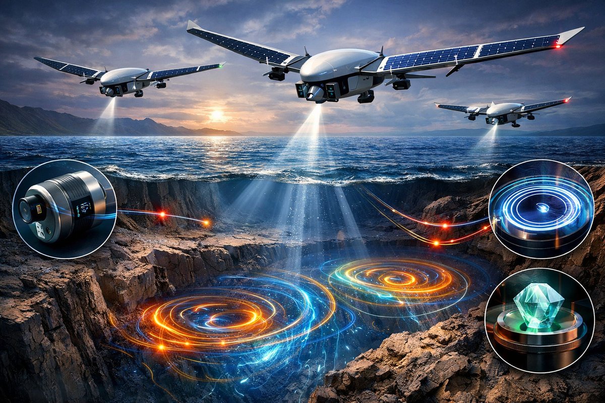
A pioneering aerial survey using a fleet of solar-powered sensor drones has revealed intricate magnetic vortices swirling miles beneath the ocean floor. Combining miniaturized magnetometers, fiber-optic gyroscopes, and quantum diamond sensors, researchers and citizen scientists are piecing together Earth's invisible choreography with unprecedented detail.
A fleet of solar-powered sensor drones has embarked on a mission to map some of the most elusive features of our planet: hidden magnetic whirlpools lurking beneath the ocean’s crust. In a recent pilot project, a research collective launched over fifty autonomous quadcopters off a remote Pacific island, each carrying a compact fluxgate magnetometer, a fiber-optic gyroscope, and environmental sensors to track temperature and pressure. Over the course of two weeks, this aerial swarm traversed a grid spanning hundreds of square kilometers, harvesting streams of data that are already reshaping our understanding of subsurface dynamics.
Traditional geomagnetic surveys rely on satellites to measure broad patterns and on ships or ground teams to conduct localized sweeps. While satellites offer global coverage, their altitude limits the resolution of fine-scale anomalies. Ship-borne surveys can detect smaller features but move slowly and incur high fuel costs. The new drone-based approach bridges that gap, coupling the agility and low operating cost of unmanned aerial vehicles with precision instrumentation once limited to laboratory settings. By flying just a few hundred meters above the ocean surface, the drones capture variations in Earth’s magnetic field at resolutions down to the tens of meters.
Each drone carries a miniaturized fluxgate magnetometer-a device that detects minute changes in magnetic field strength-and a fiber-optic gyroscope that records its orientation with sub-degree accuracy. These two instruments work in tandem: as the drone navigates complex wind patterns, the gyroscope ensures that magnetic readings can be corrected for any tilt or rotation, guaranteeing that the magnetic map reflects real geological features and not the motion of the craft.
Coordinating fifty drones to cover a sweeping survey area required sophisticated swarm-intelligence software. Researchers deployed a decentralized algorithm inspired by flocking birds, so that each drone adjusts its flight path in real time to maintain optimal spacing, avoid collisions, and fill in gaps. When one unit drifts off course due to a sudden gust of wind, its neighbors detect the void and redistribute themselves, ensuring no region goes unmeasured. This emergent behavior transforms the fleet into a dynamically adapting network, greatly reducing the need for constant remote piloting.
Preliminary analyses have uncovered surprisingly compact magnetic vortices along a segment of the mid-ocean ridge. These whirlpools, only a few hundred meters wide and twisting like miniature tornadoes in the field data, may signal localized variations in mantle convection. Such anomalies could point to pockets of molten rock churning beneath the seabed, feeding undersea volcanoes or influencing the slow drift of tectonic plates.
Even more intriguing are ring-shaped magnetic features forming near known hydrothermal vents. Data show concentric bands of slightly elevated magnetic intensity, suggesting the early stages of mineral deposition around vent openings. Over time, these rings may grow into chimneys rich in metal sulfides, the source of seafloor mineral deposits coveted for their rare elements. Unraveling their formation could help balance resource exploration with environmental stewardship.
Beyond the drone fleet, a network of citizen scientists launched sensor balloons from coastal villages to collect supplementary data at higher altitudes. Equipped with low-cost Hall-effect magnetometer kits and solar panels, these balloons ascended to stratocumulus layers, capturing how upper-atmosphere disturbances interact with the magnetic field. Using an augmented-reality mobile app, volunteers could trace the balloon’s flight path in real time, marking anomalies and cross-referencing drone data. This grassroots component has not only enriched the dataset but also fostered local environmental literacy.
Pushing the envelope further, the team integrated quantum diamond magnetometers into a handful of drones. These cutting-edge devices exploit tiny defects in diamond to measure magnetic fields at nanoscale precision. Deployed alongside the traditional sensors, they revealed flickering fluctuations that may originate from interactions between ocean currents and deep magmatic activity. Though still experimental, quantum sensors promise to detect signals so faint that they were once thought undetectable outside laboratory conditions.
The insights emerging from this project have practical applications across multiple domains. Resource mapping firms can use the high-resolution magnetic maps to target sustainable extraction of critical minerals while avoiding fragile ecosystems. Seismologists hope that monitoring shifts in magnetic vortices over time could yield early warning signs of shifting tectonic stresses, potentially improving earthquake forecasting. Climate modelers are also interested in how magnetic field variations correlate with ocean-atmosphere circulation, offering new inputs to predict long-term climate patterns.
Environmental impact and data ethics were central considerations from the outset. The drones are solar-recharged between flights, eliminating the carbon footprint of fuel-powered research vessels. Sensor pods employ biodegradable composites, ensuring that any accidental losses degrade harmlessly in the environment. All collected data is published under an open license, with strict privacy protocols to anonymize any location tags associated with citizen contributors. By prioritizing transparency and sustainability, the project seeks to set a new standard for large-scale environmental sensing.
Looking ahead, researchers plan to extend the aerial network with autonomous underwater gliders fitted with identical sensor stacks. These submarine drones will weave among the seafloor ridges, providing a complementary perspective fueled by both buoyancy control and battery power. When paired with low-Earth-orbit satellite measurements, the combined system promises a continuous, multi-scale map of Earth’s magnetic heartbeat, from deep mantle eddies to atmospheric perturbations.
As day turns to night across the survey region, the glowing green lights of the drones blinking in unison evoke an otherworldly ballet. It’s a reminder that even the forces we cannot see shape the contours of our world in silent, powerful ways. By harnessing modular sensors, emergent swarm intelligence, and a spirit of collective curiosity, this project invites everyone to witness the hidden symphony of magnets beneath our feet-and to join in the quest to decode the patterns of nature.












