Location
Mount Vernon, WA 98274

Location
Mount Vernon, WA 98274
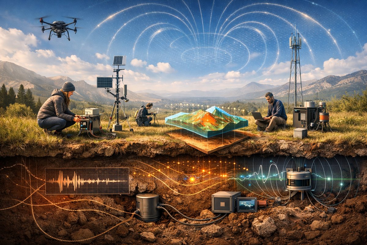
A growing wave of DIY sensor arrays and citizen science partnerships is revealing subtle patterns beneath our feet and above our heads. From microtremors to shifting magnetic fields and faint gravity fluctuations, distributed networks are turning curiosity into real-time maps of nature's undercurrents.
When a tremor rattled an isolated mountain pass this spring, the quake first registered not on a national observatory’s expensive seismometer but on a backyard device built by an amateur geophysicist. Scattered across the valley on solar-powered poles and rooftops, these compact modules picked up the faint vibration seconds before anything lit up on the official network. Their data streamed into a shared cloud, where algorithms cross-referenced the signals and confirmed an event only detectable at magnitudes below official thresholds.
This grassroots web of sensors operates much like a neural network. Each tiny unit-bristling with accelerometers, magnetometers and GPS clocks-feeds a constant stream of high-frequency measurements into an open data portal. Scientists and hobbyists alike can pull down real-time graphs of microseismic hum, chart slow drifts in the Earth’s magnetic shield and even spot minute anomalies in gravity. Together, these readings form a three-dimensional portrait of dynamic forces that once required multi-million-dollar labs to observe.
At the heart of the seismic arm of the network are MEMS-based vibration sensors similar to those in smartphones but tuned for geoscience. These chips, available for under a hundred dollars, detect ground accelerations measured in millionths of a meter per second squared. When housed in custom-printed enclosures and paired with a low-power microcontroller, they become precision instruments capable of logging thousands of data points per second. Volunteers mount them to bedrock, concrete foundations or buried stakes, calibrate them with simple hammer taps and let them record continuously.
Parallel to these units, compact magnetometer boards sense the tiniest shifts in the geomagnetic field. Often built around anisotropic magnetoresistance or fluxgate sensor chips, they can register changes as small as a few nanoteslas. When that trembling mountain pass shifted minerals underground or solar storms stirred currents in the ionosphere, these modules captured telltale signatures. Mapping magnetic gradients at high resolution has revealed underground water flows, buried faults and even migrant animal routes that follow magnetic landmarks.
Gravity sensing has historically required bulky spring-based gravimeters or advanced quantum systems. But recent educational kits harness ultra-low-drift accelerometers and simple mass-spring assemblies to demonstrate gravity variations in the lab. Although they lack the sensitivity of research-grade quantum gravimeters, these setups have engaged citizen scientists in comparative studies: building parallel rigs across multiple locations, calibrating them against known masses, and tracking tiny gravity anomalies caused by groundwater fluctuations or underground cavities.
All of this hardware relies on common software frameworks and cloud databases. Open-source libraries ingest time-stamped data packets via Wi-Fi, cellular or low-power wide-area radio. Users can subscribe to filtered event alerts-microquake detection, magnetic pulses above threshold or gravity drifts over days. Machine learning models trained on years of open data can automatically distinguish local noise (passing trucks, garden tools) from genuine geophysical signals. This democratized pipeline turns raw sensor output into actionable insights.
As the mesh of devices grows, emergent system behavior becomes apparent. In one case, a series of minor landslides registered as tiny seismic blips that synchronized with a sharp spike in magnetic noise. Analysis suggested piezoelectric effects in stressed rock layers converting mechanical strain into electrical signals. Combining both datasets helped researchers pinpoint the most unstable slope long before visible cracks appeared.
Another breakthrough occurred when an array of magnetometers across a coastal plain detected a subtle pulse hours before a cluster of thunderstorms formed offshore. The pattern matched theoretical models of charge build-up in storm clouds interacting with Earth’s field, offering a potential new tool for early severe weather warnings. Local volunteer crews reported that, with visualizations from the network’s dashboard, they could see the magnetic lines bending and stretching as electric charges danced in the air.
Beneath the waves, hydrophones and underwater pressure sensors have been added to the citizen network by coastal communities. These submerged nodes pick up acoustic signatures of migrating whales, record the hum of distant shipping lanes and even detect seabed tremors. When combined with land-based seismic units, the system paints a holistic picture of both terrestrial and marine geodynamics-helpful for earthquake early warning and tsunami risk assessment in vulnerable regions.
Aerial surveys have joined the mix as well. Lightweight drones outfitted with magnetometer payloads now skim volcanic craters, mapping magnetic anomalies left by cooled lava flows. Pilots program grid-pattern sweeps at different altitudes, then upload the magnetometer logs on landing. Comparing these aerial runs with ground and underwater measurements yields a four-dimensional view of subsurface structures-critical data for volcanic hazard monitoring.
Of course, running a global citizen network comes with challenges. Each sensor requires calibration to account for temperature changes, electromagnetic interference from nearby electronics and time-drift in its internal clock. Remote locations often lack reliable power and data connectivity, pushing some nodes to store gigabytes of readings for days before syncing. Data privacy concerns arise when sensors sit near private property or track human-made vibrations. Coordinating all these volunteers and maintaining quality control demands robust documentation and community moderation.
The next frontier lies in scaling these efforts with compact quantum sensors and swarm robotics. Quantum magnetometers promise sensitivities orders of magnitude finer, capable of detecting unseen mineral deposits or hidden fault lines. Teams are already experimenting with small rovers that carry sensor bundles into dense forests or collapsed tunnels. Combined with satellite links, these mobile units could fill in data gaps unreachable by static posts.
Beyond pure research, the network empowers communities to monitor local hazards, water resources and infrastructure health. Schools install mini-arrays to teach students about waveforms, electronics and data science. Farmers track soil moisture and subsurface water tables by correlating gravity drift with irrigation patterns. Hikers and outdoor enthusiasts share real-time alerts about rockfall risks on trails. In each case, curiosity sparks practical solutions rooted in sustainability and collective stewardship of the planet.
Imagine a future when every rooftop, boat deck and trail kiosk hosts a multipurpose geophysical sensor. Real-time dashboards display the planet’s pulse-minute shifts in gravity after heavy rains, the low-frequency hum of distant earthquakes, the faint twist of magnetic field lines as they react to solar storms. By weaving together tens of thousands of volunteer modules, we transform Earth into a living laboratory and ourselves into attentive witnesses of nature’s subtle symphony.
Through open collaboration and accessible technology, the boundaries between professional laboratories and personal curiosity blur. The next time the ground beneath you trembles, the compass swings or your portable gravity rig registers a pulse, you won’t just feel the world’s hidden forces-you’ll be part of the network that reveals them to all.












