Location
Mount Vernon, WA 98274

Location
Mount Vernon, WA 98274
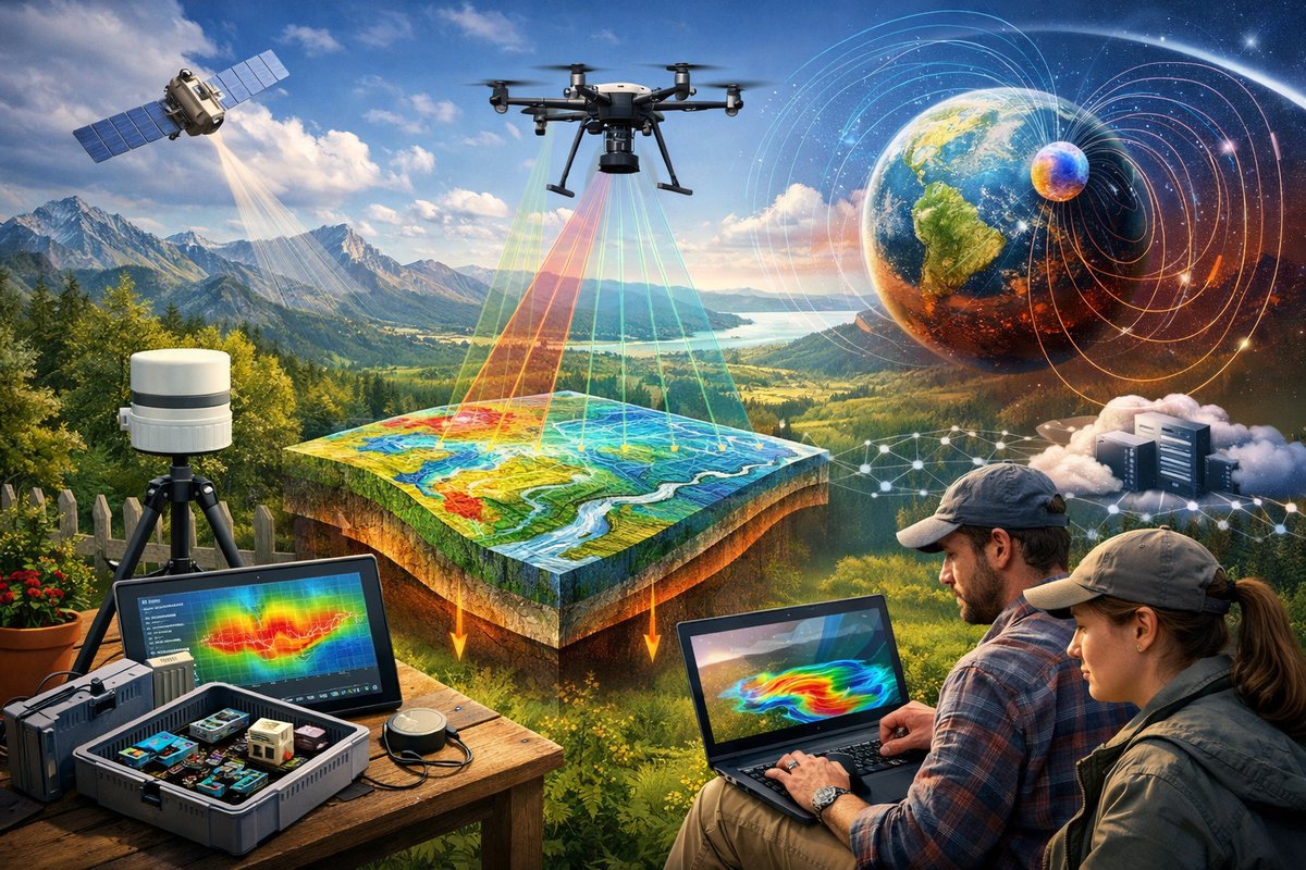
From backyard sensors to drone flights, a new wave of citizen science is mapping gravity, magnetism, and fluid dynamics with surprising precision. By combining open-source hardware, cloud analytics, and collaborative networks, volunteers are revealing the subtle forces that shape landscapes, climate, and infrastructure.
Every rock, every swirling current, and every passing gust is governed by forces that are all around us yet remain largely unseen. Gravity tugs at our feet, magnetism threads through the crust, and fluid vortices choreograph rivers and oceans. Once confined to elite laboratories, the measurement of these natural phenomena has leaped into the hands of curious individuals who are turning parks, rooftops, and riverbanks into experimental labs. This citizen-powered revolution is not just generating data-it’s inspiring fresh perspectives on Earth’s hidden dynamics.
It began with the ubiquity of smartphones. Modern handsets come equipped with magnetometers, accelerometers, barometers, and gyroscopes originally intended to detect device orientation and motion. Dedicated apps transform these built-in components into pocket laboratories, letting users record local magnetic field variations or tiny changes in gravitational acceleration. A recent pilot project in coastal communities enlisted hundreds of volunteers to walk predetermined routes with a magnetometer app running in the background. Their aggregated results unveiled subtle magnetic anomalies aligned with buried pipelines and old wells-information previously available only through costly surveys.
Beyond smartphones, hobbyists and educators are turning to low-cost sensor modules that connect to microcontrollers. A typical kit includes a three-axis magnetometer chip, an inertial measurement unit, and a barometric pressure sensor. Paired with a small battery pack and an open-source flight controller, these modules can hitch a ride on recreational drones. Drone-borne magnetics surveys once required six-figure equipment; today, community teams deploy quadcopters at neighborhood festivals, scanning old quarries and landfill sites. The resulting magnetic maps have practical uses, from pinpointing metal debris in recreational parks to guiding ecological restoration efforts.
Gravity, the most universal of forces, is even more elusive to map at fine scales. Research labs use superconducting gravimeters and spring-based instruments that cost tens of thousands of dollars. In contrast, several grassroots collectives have experimented with open designs based on MEMS accelerometers. By mounting these sensors on stabilized platforms-either gimbaled to counteract drone motion or suspended on robust tripods-volunteers can detect changes in gravitational pull as small as a few microgals. Such sensitivity allows for the mapping of shallow subsurface features, enabling backyard prospection of old mine shafts or sinkholes before they become hazards.
Meanwhile, a quieter revolution is under way in fluid dynamics. Portable flow-visualization kits-complete with dye injectors, mini-pumps, and clear acrylic channels-are enabling students and amateur scientists to watch vortices swirl in miniature river models. These experiments shed light on how eddies form around bridge pylons, why pollutants accumulate in river bends, and how microplastics travel in coastal zones. Complementing these tabletop labs, teams are deploying waterproof sensors that measure pressure fluctuations and velocity profiles directly in streams. By combining on-site readings with high-resolution satellite imagery, it’s now possible to predict flood hotspots with unprecedented granularity.
The real magic emerges when data from disparate sources converge. Volunteer-collected magnetometer scans, DIY gravimeter logs, fluid flow readings, and even local weather station reports are streamed into cloud platforms that run real-time analytics. Open-source software stacks-including geospatial libraries, machine learning toolkits, and collaborative repositories-allow participants to visualize anomalies on interactive maps, flag outliers, and refine measurement protocols. This decentralized approach contrasts sharply with traditional studies where data flows up a rigid hierarchy. Instead, community members feel a sense of ownership over both the process and the outcomes.
Consider a recent project in a mountainous region where locals suspected old mining tunnels could trigger landslides. A loose network of hikers, local guides, and school teachers formed a mapping party. Over weekends, they carried magnetometer and gravity sensor kits along hiking trails. The scans pinpointed several zones with significant mass deficits-indicative of voids beneath the surface. Armed with this information, municipal planners were able to commission targeted ground-penetrating radar surveys, averting potential disasters in vulnerable villages.
Across the Atlantic, a river conservation group used fluid dynamics kits to assess the impact of new footbridge pilings on local water flow. Volunteers released harmless dye tracers and recorded vortex formation using high-speed smartphone footage and pressure sensors taped to kayaks. The data revealed that one design funneled high-speed currents toward spawning grounds for endangered fish species. Armed with these insights, the group persuaded engineers to modify the pile placements, reducing harm to the ecosystem without compromising structural integrity.
These initiatives often sprout from hackathons, community science fairs, or local university outreach programs. At one urban event, participants assembled sensors from salvaged electronics parts and learned to calibrate magnetometers using simple reference magnets. Crowdsourced tutorials and friendly competitions incentivize accuracy and creativity. Winners may have the most precise gravity profile of a schoolyard, or they might craft the most compelling visualization of magnetic field lines swirling around a playground slide.
Challenges remain. Consistency in calibration is essential-tiny misalignments can produce spurious readings. Data quality can suffer when sensors overheat in direct sunlight or when drone propellers create electromagnetic interference. Citizen scientists address these issues by developing standard operating procedures, often documented in shared wikis. Concerns around privacy and land access also come into play; mapping private property without permission raises ethical and legal questions. Many groups adopt transparent data policies, anonymizing location data and obtaining written consent for fieldwork on private land.
Looking ahead, the next frontier lies at the intersection of swarm robotics and edge computing. Imagine fleets of small drones equipped with magnetometers and gravimeters, autonomously mapping large tracts of land while coordinating with edge-based AI that filters and flags anomalies in real time. Such systems could monitor coastal erosion dynamically, track the spread of sinkholes in karst landscapes, or detect underground water flows that signal drought stress. Quantum sensors-once confined to national laboratories-are also shrinking in size and cost. Quantum diamond magnetometers and chip-scale atomic gravimeters promise sensitivities far beyond current MEMS-based devices, opening doors to detecting seismic precursors and mapping deep mineral deposits.
The social dimension is equally exciting. As more communities embrace participatory science, they build local capacity for decision-making. Farmers can use microgravity surveys to optimize irrigation, civic groups can track soil nutrient depletion via electromagnetic conductivity, and educators can foster STEM engagement by turning playgrounds into classrooms. The boundary between professional and amateur research blurs, creating a networked ecosystem where curiosity drives both discovery and problem-solving.
In this age of environmental uncertainty, mapping invisible forces is more than an academic exercise-it’s a toolkit for resilience. By illuminating subsurface cavities, guiding infrastructure design, and modeling fluid flows, citizen-driven investigations can help societies adapt to climate shifts, mitigate natural hazards, and steward natural resources more wisely. The journey from backyard sensors to sophisticated quantum devices underscores a broader truth: science, at its heart, is an invitation to wonder and to act.
Whether you’re a hobbyist eager to launch your first magnetometer drone or an educator seeking hands-on lessons for students, a wealth of open-source plans, sensor modules, and community forums awaits. The invisible tapestry of forces around us is ripe for exploration-and each new measurement brings us closer to understanding the delicate balance that shapes our planet.












