Location
Mount Vernon, WA 98274

Location
Mount Vernon, WA 98274
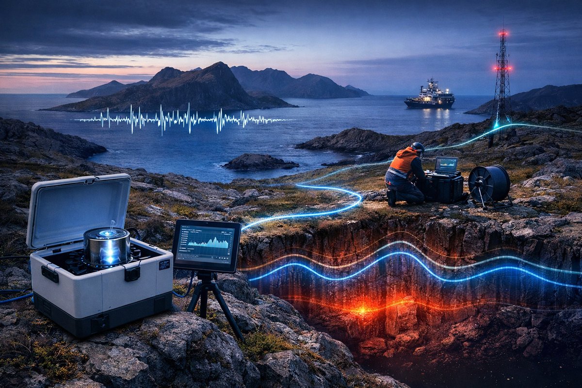
A pioneering expedition has combined portable quantum gravimeters with fiber-optic acoustic sensing to chart gravity anomalies and seismic murmurs across a remote archipelago. This fusion of cutting-edge physics and telecommunications infrastructure is revealing subtle shifts beneath Earth's surface and redefining how researchers and citizen scientists can tap into nature's hidden rhythms.
On a wind-swept coastline far from the reach of paved roads, a team of geophysicists and engineers gathered around a small beachhead laboratory. Suspended over the sand was a network of fiber-optic cables, originally laid for high-speed Internet, now repurposed as an all-seeing ear for the Earth’s most delicate vibrations. Nearby, a backpack-sized quantum gravimeter hummed softly, its atom interferometer measuring minute fluctuations in gravity as the tide ebbed and flowed. Together, these instruments formed the core of an unprecedented mission: to map invisible forces that shape our planet, from tiny density variations beneath a volcano to acoustic murmurs from distant earthquakes.
Invisible to the human senses, gravity anomalies and seismic whispers have long driven scientific curiosity and practical applications alike. Traditionally, mapping these fields required large survey vessels, heavy land vehicles, and fixed seismic stations. But recent breakthroughs in quantum sensors and distributed acoustic sensing (DAS) over fiber-optic infrastructure are democratizing access to Earth’s hidden dynamics. Portable quantum gravimeters now weigh less than 30 kilograms, and telecommunication cables spanning hundreds of kilometers can be tapped to reveal ocean swell patterns, submarine landslides, or the telltale hum of magma moving underground.
Quantum gravimeters exploit the wave nature of atoms. In a vacuum cell, clouds of cooled atoms are split into two distinct paths by laser pulses. As gravity accelerates one cloud slightly more than the other, they accrue a tiny phase shift. When recombined, these atoms produce interference patterns that translate into gravity readings accurate to within a few microgals (one microgal equals one-billionth of the acceleration due to gravity). A research group at a European metrology institute unveiled a backpack model last year, demonstrating field operations in mountainous terrain. Its compact form factor opened the door for geologists, archaeologists, and even prosumers to carry gravity sensing into remote valleys and urban basements alike.
Meanwhile, fiber-optic DAS technology has been quietly transforming submarine cables and buried telecom lines into sprawling seismic observatories. By sending laser pulses down each fiber and measuring the backscattered light, engineers can detect ground vibrations along every meter of cable. This method provides continuous, high-resolution acoustic data across hundreds of kilometers, far exceeding the coverage of a typical seismic station. On the U.S. West Coast, researchers tapped a stretch of submarine fiber to monitor microseisms generated by ocean waves crashing ashore. In another demonstration, an onshore fiber network detected tremors from a magnitude 4.2 earthquake more clearly than several dedicated seismometers in the same region.
On this expedition, scientists fused these two approaches. As volunteers from a citizen-science network carried quantum gravimeters inland, an autonomous surface vehicle towed fiber-optic lines around a volcanic island. Each evening, data streamed into a floating lab where machine-learning algorithms aligned gravimetric and acoustic anomalies. The result was a high-resolution map of density variations in the island’s magma chamber, fault zones where tiny fractures were opening, and even subsurface water channels feeding thermal springs along the shore.
One startling discovery arose at the water’s edge. The fiber-optic array picked up a low-frequency hum that intensified at high tide. Correlating that acoustic signature with gravity data, researchers pinpointed a shallow aquifer being pressurized as seawater intruded during each tidal cycle. This aquifer had gone unnoticed by previous surveys, yet it feeds several freshwater springs vital to local communities. Armed with this insight, coastal managers can now plan more targeted monitoring to protect groundwater resources in the face of rising sea levels.
Another breakthrough emerged from the volcanic highlands. Quantum gravimeter readings revealed a subtle local decrease in gravitational acceleration-a sign of material moving upward but too minor for conventional instruments to detect. Combining that with fiber-optic records of low-magnitude acoustic events, the team confirmed a deep magma conduit was widening by mere millimeters per day. Such granular monitoring offers a new early-warning capability for volcanic hazards, allowing authorities to evacuate high-risk areas days or weeks before a potential eruption.
In addition to gravity and sound, the mission incorporated emerging portable magnetotelluric probes. These compact devices measure fluctuations in Earth’s magnetic and electric fields, which can reveal conductive fluid pathways in the crust. By combining all three data streams-gravimetric, acoustic, and electromagnetic-the expedition achieved a multilayered view of subsurface processes, akin to having X-ray vision for Earth’s interior.
Data processing relied on state-of-the-art AI models trained on seismic, gravimetric, and magnetotelluric datasets from global observatories. These neural networks learned to disentangle overlapping signals-such as separating the hum of distant cargo ships from volcanic tremors or distinguishing soil moisture changes from gravity shifts caused by rock fractures. The models also flagged anomalous patterns in real time, alerting the field team whenever new hotspots of activity emerged.
While this expedition was led by senior researchers and engineers, the underlying technologies are set to trickle down to broader audiences. Amateur geologists can now purchase entry-level quantum gravimeters for a few thousand dollars, and open-source DAS kits for standard fiber. Citizen science groups have begun organizing gravity “treks,” where volunteers collect data along hiking trails to detect hidden cavities or archaeological sites. In coastal communities, surfers equipped with waterproof acoustic loggers are mapping underwater wave patterns and micro-earthquakes when they catch morning swells.
Beyond hazard monitoring and resource exploration, these innovations hold promise for urban planning and climate resilience. City engineers could deploy fiber-optic sensing within underground utility corridors to detect early signs of sinkhole formation or water pipe leaks. Agricultural researchers might use gravimeters to track soil compaction and water content across large fields, optimizing irrigation and preserving groundwater. Even in remote polar regions, portable quantum sensors could measure ice sheet mass changes more accurately than satellite missions, refining climate models and sea-level rise projections.
Yet challenges remain. Quantum gravimeters require precise temperature control and vibration isolation, making them sensitive to harsh field conditions. Fiber-optic DAS systems can generate voluminous data burdens, demanding robust on-site processing or high-bandwidth links. Ethical considerations around tapping private telecom infrastructure also come into play, requiring transparent partnerships between researchers and network operators.
Despite these hurdles, the convergence of quantum physics, optical telecommunications, and artificial intelligence is ushering in a new era of Earth observation. What was once confined to large-scale institutes and specialized ships is now accessible to regional agencies, universities, and even dedicated hobbyists. This democratization of sensing is not only advancing science but weaving a network of informed stewards capable of listening to the planet’s ever-changing heartbeat.
In the end, the invisible forces of gravity, magnetism, and seismic vibrations guide everything from magma migration to water tables, and from urban infrastructure health to the slow dance of glacial ice. By shining a light-or rather, by tuning into the subtle whispers-of these phenomena, researchers are rewriting the story of how we understand and coexist with Earth’s hidden dynamics. The future belongs to those who can listen closely, interpret wisely, and act with foresight as our planet’s invisible ballet unfolds beneath our feet.












