Location
Mount Vernon, WA 98274

Location
Mount Vernon, WA 98274
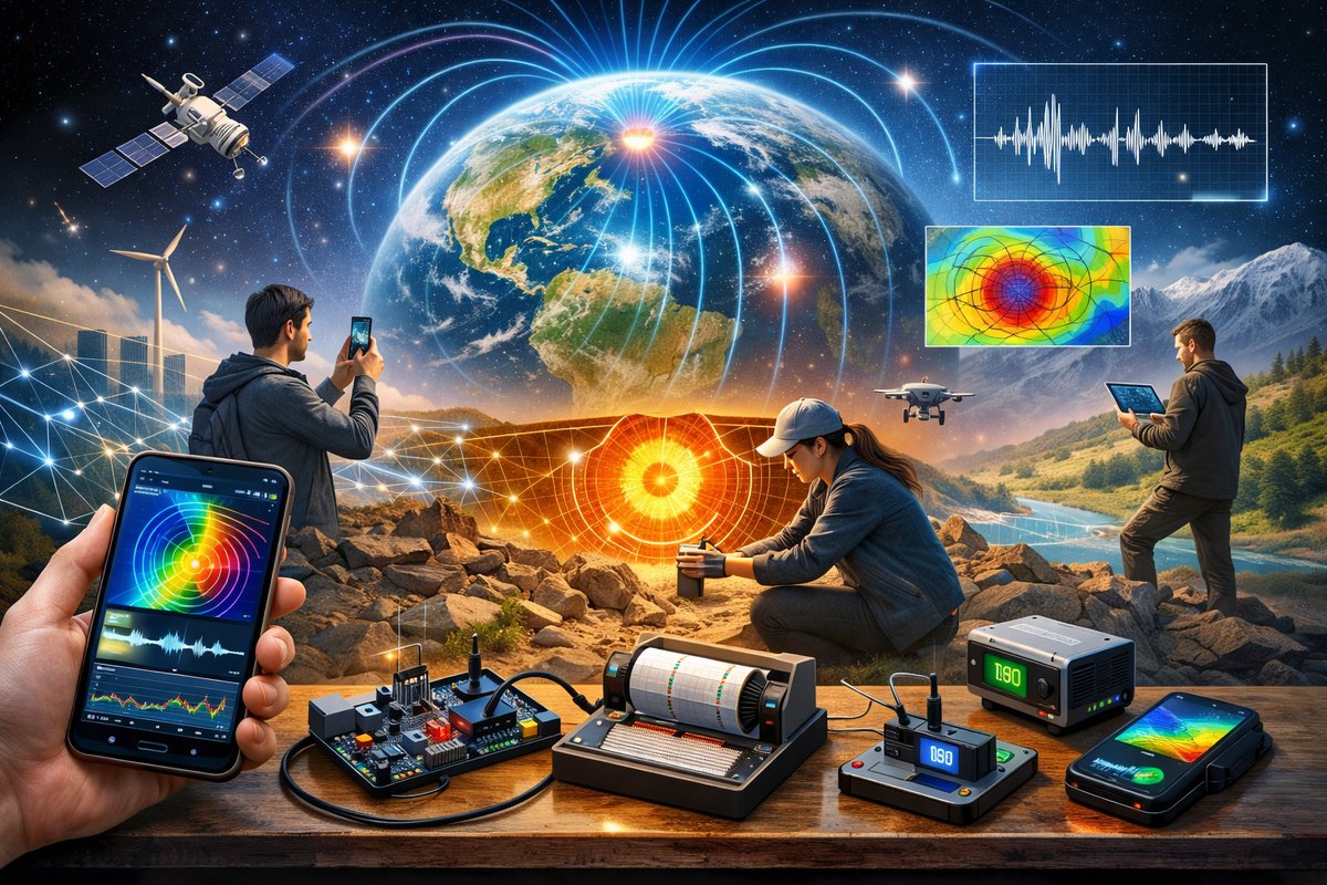
A groundbreaking global initiative is enlisting everyday devices and DIY sensor kits to map subtle magnetic quirks, microgravity anomalies and seismic whisperings. By harnessing smartphones, open hardware and crowdsourced data, scientists and citizen researchers are revealing a dynamic portrait of Earth's hidden forces.
A new consortium has launched the Global Natural Forces Monitor (GNFM), a crowd-powered network that transforms smartphones and open-source sensor modules into a planetary observatory. Spearheaded by leading geoscience organizations and backed by open data advocates, this platform invites anyone with a mobile device or a DIY kit to contribute magnetic, gravitational and seismic readings. In doing so, GNFM aims to unlock high‐resolution maps of Earth’s invisible dynamics-from subtle magnetic anomalies to microgravity shifts and seismic tremors that hint at subsurface structures.
Smartphones have long carried magnetometers as part of their compass functions, but the GNFM initiative repurposes these tiny sensors to sample the Earth’s magnetic field at unprecedented density. Volunteers around the globe install a dedicated app that records orientation, raw magnetic flux values and timestamps, then uploads anonymized entries to a cloud database. By combining readings from millions of phones, researchers hope to sharpen regional magnetic maps, revealing hidden faults, mineral concentrations and groundwater flow patterns that traditional surveys can miss.
Calibration is critical when relying on consumer-grade hardware. GNFM provides step-by-step guidelines on stabilizing a phone with a tripod mount or stand, orienting it with respect to true north and compensating for local electronic interference. The app then applies a multi-stage correction algorithm, filtering out noise from nearby power lines or metallic structures. Early tests in urban districts have demonstrated that, with proper protocol, smartphone magnetometers can achieve field accuracy within a few hundred nanoteslas-enough resolution to detect anomalies spanning a kilometer in size.
Alongside magnetics, the pilot program incorporates dedicated electromagnetic field (EMF) meters that hobbyists can purchase or assemble. These handheld devices measure low-frequency electromagnetic fluctuations, complementing magnetometer data and painting a fuller picture of subsurface conductivity. Data streams from both smartphone and EMF meters feed into a unified visualization portal, where users can overlay magnetic intensity, EMF variation and topographic maps to spot correlations and anomalies in real time.
Seismic mapping also takes center stage in the GNFM effort, thanks to advances in accelerometer technology embedded in modern phones. Participants place their devices on stable surfaces overnight or whenever no significant movement is detected. The app records microtremors-tiny, continuous vibrations generated by ocean waves, wind, and human activity. By aggregating these subtle signals across a dense network, scientists are performing passive seismic tomography without deploying bulky geophones, unveiling shallow crustal features and sedimentary basin shapes with surprising fidelity.
Gravity gradiometry is the next frontier for citizen geophysics. While traditional gravimeters are expensive and delicate, open-source hobbyist kits based on spring accelerometers and laser interferometry prototypes have begun to emerge. Early adopters in mountainous regions have already captured minute spatial variations in gravitational pull linked to underground voids, mineral veins and groundwater reservoirs. Though still in beta, these DIY gravity meters promise to democratize a technique once reserved for advanced research labs.
A recent study in Geophysical Research Letters highlighted the potential of high-density magnetometer crowdsourcing for mineral exploration. The paper demonstrated that combining thousands of low-cost readings could refine the location of a known iron ore deposit to within a few hundred meters. GNFM organizers believe that wider participation will extend this success to untapped regions, reducing the environmental footprint and cost of traditional airborne or vehicular surveys.
All data collected by GNFM is publicly accessible through an interactive portal called OpenEarthView. Users can pan and zoom across layered maps, apply custom filters and even download raw datasets for their own analyses. The interface supports time-lapse playback to watch seasonal or weather-driven changes in magnetic and gravitational fields. Educators and community groups have already begun using the tool in classrooms and workshops, fostering curiosity about Earth’s invisible dynamics.
However, crowdsourced geoscience faces challenges. Data quality varies with equipment and technique, and volunteers must adhere to strict calibration routines. GNFM has held online training sessions, producing video tutorials on tripod setup, noise reduction and quality control metrics. Regional coordinators host local meetups where participants compare results, refine methods and troubleshoot sensors in the field.
Sustainability and inclusivity are core values for the project. Many sensor modules are fabricated from recycled electronics, and detailed assembly guides promote frugal, low-waste construction. Users can repurpose smartphone sensors, old laptops and leftover 3D-printed mounts to build their own kits. The open-hardware ethos encourages repair and sharing, reducing electronic waste and fostering a global maker community passionate about geophysics.
Looking ahead, GNFM plans to integrate advanced quantum sensor modules. Diamond nitrogen-vacancy point magnetometers, atomic interferometers and cold-atom gravimeters are on the horizon for citizen deployment. While these devices remain costly today, ongoing miniaturization and open-source innovations hint at a future where quantum-grade precision will be household science. Enthusiasts could one day map Earth’s magnetic microstructures and gravitational subtleties with sensors no larger than a matchbox.
The implications of a dense, global network of natural-force monitors are far-reaching. From optimizing resource exploration and locating water aquifers to tracking volcanic unrest and forecasting landslide risks, high-resolution force maps can inform critical environmental and infrastructure decisions. Urban planners could use seismic noise data to assess building safety, while archaeologists might detect buried ruins through subtle gravitational discrepancies.
A representative from one of the lead organizations explains that GNFM’s ethos bridges professional research and public wonder. By breaking down technical barriers, the initiative transforms curious individuals into active contributors to geoscience. Each sensor reading-no matter how modest-joins a much larger tapestry, revealing patterns that are invisible to any solitary investigator.
Participation is straightforward. Interested users download the GNFM app or assemble a sensor kit guided by open-source schematics. After a brief calibration routine, devices upload readings automatically whenever connected to Wi-Fi or mobile data. Contributors can review their own data, explore community maps and share findings on social media, fostering a sense of shared discovery.
Privacy and data ethics are built into the platform. Location data is fuzzed within a small radius to prevent pinpointing private residences or sensitive areas, and users can opt out of sharing their raw GPS coordinates. Raw sensor values remain accessible for scientific reuse, but personal identifiers are stripped to ensure anonymity and trust.
Beyond practical applications, GNFM emphasizes emotional resonance. Contributors often describe a newfound connection to Earth’s living systems as they observe magnetic anomalies drifting across their neighborhood or feel the faint tremors of distant storms. This citizen-powered approach cultivates stewardship and curiosity, reminding people that scientific discovery can happen in backyards and living rooms.
The project also underscores sustainability by championing modular sensor designs and repairable devices. Community workshops teach soldering, part swapping and firmware updates, ensuring that kits remain functional for years. Repair cafes and online forums support troubleshooting, reinforcing a culture of sharing and reducing e-waste.
In the coming months, GNFM will expand partnerships with environmental agencies, earth science educators and humanitarian organizations. Pilot programs in regions prone to natural hazards will test how real-time data streams can enhance early warning systems for earthquakes, landslides and volcanic eruptions. Meanwhile, hobbyists will continue to refine their sensor rigs, pushing the boundaries of DIY geophysics.
By harnessing the power of citizen networks, affordable hardware and open-source software, GNFM is forging a new lens for understanding our planet’s invisible forces. From magnetism to gravity and seismic murmurs, the initiative invites everyone to join a planetary quest-turning handheld devices and repurposed components into gateways to Earth’s hidden dynamics.












