Location
Mount Vernon, WA 98274

Location
Mount Vernon, WA 98274
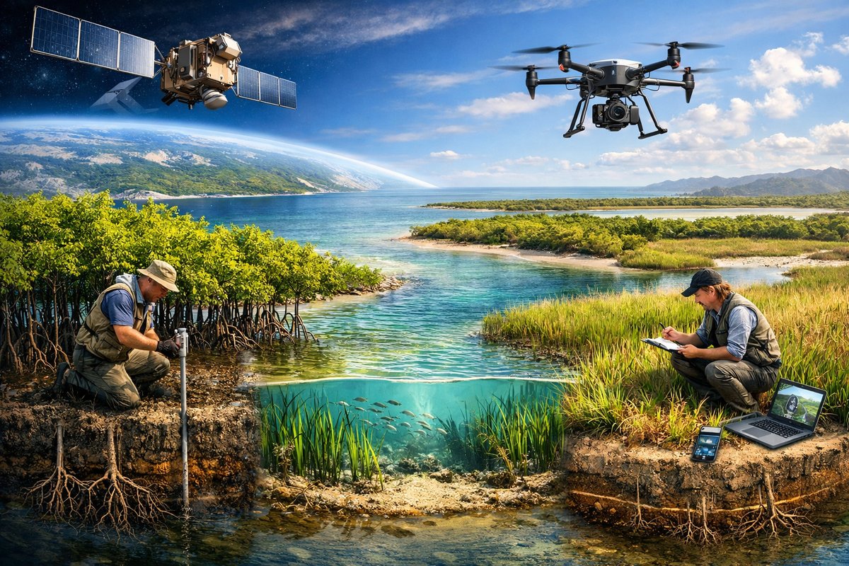
A pioneering collaboration of satellite imagery and drone-based surveys is transforming our understanding of blue carbon ecosystems along coastlines. High-resolution data and on-the-ground validation are now converging to reveal carbon stocks in mangroves, seagrasses, and salt marshes with unprecedented clarity.
In a recent pilot program along the Gulf Coast, researchers combined satellite data with custom drone flights to chart carbon stores in coastal wetlands. For decades, mangroves, salt marshes, and seagrass meadows were recognized as potent carbon sinks, but accurate measurements of their storage capacity remained elusive. The advent of high-resolution aerial platforms and open-source processing tools has changed that. In the latest surveys, drones equipped with multispectral sensors flew low over winding channels and dense root networks, capturing leaf and soil signatures that satellites alone cannot resolve. By fusing those readings with broader satellite mosaics, scientists are assembling detailed carbon inventories that span tens of thousands of acres.
Satellite imagery offers a bird’s-eye perspective of shoreline dynamics, capturing changes in vegetation cover and sediment deposition over months or years. However, the spatial resolution of standard Earth-observation platforms-often several meters per pixel-can miss small channels and thin patches of seagrass. Drones, by contrast, can survey a site at centimeter-scale resolution. In practice, teams launch fixed-wing drones at dawn when winds are light. Onboard multispectral cameras measure reflectance across visible and near-infrared bands, revealing chlorophyll density and water clarity. Customized flight paths ensure repeatable coverage, while GNSS-enabled autopilot systems log precise coordinates.
Back on shore, researchers collect ground-truth samples-soil cores, leaf clippings, and water chemistry tests-to calibrate their aerial readings. This data fusion workflow reduces uncertainty in carbon estimates from more than 30 percent down to single digits. As one project lead explained, “We’re not just counting hectares of vegetation. We’re measuring how many kilograms of carbon each patch holds, and how that may shift with tides, storms, or restoration efforts.”
Three ecosystems stand at the center of the blue carbon revolution:
Mangrove forests line tidal passages with complex root webs that trap sediments and sequester carbon in deep soils. Traditional surveys relied on labor-intensive field plots, but drone surveys now map root density and canopy height across entire estuaries.
Seagrass meadows carpet shallow bays in underwater grasses. While invisible to land-based observations, drone-mounted hyperspectral imagers penetrate clear waters to measure leaf area index and biomass. By comparing imagery across seasons, scientists track dieback events and recovery cycles.
Salt marshes occupy the intertidal fringe, alternating between submerged and exposed conditions. Here, thermal sensors on drones record ground temperature profiles, indicating soil moisture and microbial activity that influence carbon turnover.
In each habitat, the joint use of satellite and drone data allows for the rapid assessment of restoration sites. Where replanting efforts have created new marsh squares or hydrogel-assisted mangrove nurseries, teams can verify success within weeks. This agility enables adaptive management: if a planting area shows poor growth, managers can intervene immediately rather than waiting years for manual surveys.
The science of blue carbon is no longer confined to academic labs. Coastal communities, indigenous stewards, and local conservation groups are taking part in data collection. Equipped with rugged handheld GPS units and water-proof smartphones, citizen scientists log tidal heights, water salinity, and plant health observations. Drone operators from neighborhood chapters coordinate with researchers to fill mapping gaps during community field days.
Educational workshops teach volunteers how to interpret multispectral images and run quality checks on soil samples. In one initiative, high school students monitored regrowth in a restored marsh, comparing drone mosaics from spring and fall. Their findings helped secure additional funding for shoreline buffers in vulnerable neighborhoods. By opening access to these remote-sensing tools, the program fosters both environmental literacy and a shared sense of stewardship.
Accurate carbon inventories are vital as carbon credit markets begin to include blue carbon projects. Governments and private buyers need transparent, verifiable data to fund large-scale restoration and conservation. The standardized workflows emerging from these pilot studies are being shared under open licenses, ensuring that organizations worldwide can adopt best practices.
Yet challenges remain. Cloud cover still hampers satellite observations in tropical zones during monsoon seasons. Drone flights require regulatory approvals and skilled operators, limiting deployment in sensitive or high-traffic areas. Data processing pipelines demand robust computing resources, and calibrating multispectral readings across different sensors introduces potential biases.
To address these hurdles, interdisciplinary teams are developing hybrid approaches. In cloud-prone areas, researchers are experimenting with low-altitude balloon platforms that hover above the canopy layer for extended periods. Advances in edge computing enable preliminary image processing onboard drones, reducing the need to transfer large files between field sites and cloud servers. Meanwhile, cooperative agreements with aviation authorities aim to streamline flight authorizations for environmental surveys.
As the climate crisis intensifies, every ton of stored carbon counts. Coastal ecosystems are frontline defenders against sea-level rise and storm surges, and their capacity to lock away carbon is a precious resource in mitigation strategies. By marrying the broad reach of satellites with the pinpoint accuracy of drones, scientists and communities are gaining a clearer picture of these vital blue carbon stocks.
The implications extend beyond carbon accounting. Detailed habitat maps reveal areas of biodiversity hotspots, zones at risk of erosion, and promising sites for future restoration. When policymakers have access to concrete data about how much carbon a mangrove belt stores or how seagrass meadows recover after a hurricane, they can make better-informed decisions about land use and coastal resilience.
Join this wave of innovation and become part of a movement that honors the hidden power of shorelines. Whether you’re a scientist, a community leader, or simply a curious observer, the tools are in your hands. Together, satellite by satellite and drone by drone, we can safeguard the living world at the water’s edge and ensure that coastal ecosystems continue to thrive and protect us for generations to come.