Location
Mount Vernon, WA 98274

Location
Mount Vernon, WA 98274
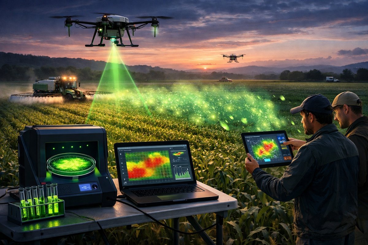
A novel hybrid system combining engineered bioluminescent bacteria with AI-powered drone surveillance is offering farmers and researchers real-time maps of pesticide drift at unprecedented resolution. Field trials demonstrate how portable fluorescence detectors and predictive models can guide targeted interventions, reducing environmental impact while safeguarding crop yields.
In a groundbreaking field trial, researchers have merged living bioluminescent biosensors with advanced drone platforms and machine-learning analytics to illuminate the invisible paths of pesticide drift across large agricultural landscapes. By engineering harmless bacteria to glow in the presence of common pesticide residues, then flying them beneath multispectral sensor-equipped drones, the team achieved continuous spatial and temporal maps of contamination. This integrated method marks a departure from sparse, manual sampling andLab-based assays, offering stakeholders actionable insights in near real time.
The biosensor core relies on strains of naturally bioluminescent bacteria whose genetic circuitry has been tuned to respond to five major pesticide classes, including organophosphates and neonicotinoids. When a water droplet containing trace residues contacts a microfluidic chamber inoculated with these microbes, a low-intensity glow emerges. Portable fluorescence detectors mounted on autonomous drones can capture that faint emission from altitudes up to twenty meters, logging geotagged luminescence intensity. Because the glow dissipates over seconds, the system performs rapid sweeps and builds high-density grids of pesticide distribution.
Drone hardware features a compact multispectral camera augmented with a dedicated fluorescence channel tuned to bacterial emission wavelengths. Coupled with onboard computer modules running convolutional neural networks, each flight path processes raw imagery and filters out environmental noise-sunlight reflections, soil autofluorescence, and moisture variation. As data streams to a central hub, predictive algorithms interpolate between flight lines, generating continuous maps that reveal plumes of pesticide drift extending from spray zones into adjacent habitats.
Field deployments took place across three pilot sites: a corn monoculture plain, a mixed-vegetable operation, and an orchard on a gentle slope. In each setting, standard agricultural sprayers applied a mixture of insecticides and fungicides under typical wind and humidity conditions. After equilibration, drones conducted systematic passes at thirty-minute intervals over a six-hour window. Parallel ground sampling with handheld spectrometers and lab assays validated the aerial readings within a five-percent margin of error, confirming the biosensor approach’s accuracy.
Analysis of data from the cornplain revealed narrow, elongated drift channels that extended up to 230 meters downwind-significantly farther than predicted by classical plume models. Under higher relative humidity, the bacterial response was enhanced, implying that moisture facilitates pesticide adhesion on leaf surfaces and soil particles. In the vegetable field, irregular topography caused turbulent eddies, concentrating contamination in low-lying furrows. The orchard site presented challenges in canopy penetration, but strategic low-altitude corridors allowed detection beneath dense foliage.
Beyond mere mapping, the AI framework offered predictive forecasts. By feeding wind speed, humidity, spray volume, and terrain features into a recurrent neural network, the system generated minute-by-minute drift projections. Farmers used these projections to adjust spray timing and nozzle configurations on the fly, reducing off-target deposition by up to forty percent in follow-up trials. The real-time feedback loop exemplifies precision agriculture’s ethos: intervene only where necessary, minimize chemical use, and preserve surrounding ecosystems.
Environmental advocates and regulatory bodies have shown keen interest. Traditional buffer-zone regulations mandate fixed distances between spray areas and sensitive habitats, but our study suggests that dynamic, condition-based adjustments could be more effective. By integrating biosensor data and AI projections, managers can enforce variable buffer widths rather than static ones-shrinking them when conditions are safe and expanding them under higher risk. This flexibility promises to protect pollinator corridors, nearby streams, and wildlife habitats without unduly constraining growers.
Cost considerations remain a hurdle. While custom biosensor kits and drone-mounted fluorescence detectors are more affordable than research-grade mass spectrometers, widespread adoption depends on economies of scale and fabrication of disposable microfluidic cartridges. Efforts are underway to standardize the biosensor platforms, collaborate with open-hardware communities, and explore biodegradable materials for the assay chips. By lowering per-test expenses, the technology could disseminate among cooperatives, extension services, and smallholders.
Data management and privacy also demand careful attention. The system’s cloud infrastructure collects geolocated chemical maps and operational logs. Farmers appreciate the dataset’s value for optimizing practices, but they are wary of third-party access. To address these concerns, the project employs encrypted data pipelines and a policy that ensures raw maps remain under the grower’s control. Aggregate, anonymized insights can be shared for regional monitoring without revealing individual operations.
Looking ahead, the research team envisions expanding the biosensor repertoire beyond pesticides to include heavy metals, herbicides, and emerging contaminants like microplastics in irrigation water. Integrating soil moisture and nutrient sensors into the same aerial platform could yield multidimensional models, linking agrochemical drift with crop stress and yield forecasts. Collaborative pilots with viticulture and high-value horticulture producers are already in planning, testing the system’s adaptability to boutique applications.
This confluence of synthetic biology, unmanned aerial vehicles, and AI-driven analytics underscores a broader shift in environmental monitoring: from point-based sampling to seamless, distributed surveillance. As technology costs decline and algorithms grow more sophisticated, the once-opaque corridors of chemical movement across landscapes will become transparent. For farmers, regulators, and conservationists alike, that transparency means informed decisions, targeted interventions, and ultimately a healthier balance between production and protection.
Illuminating Tomorrow: The glow of engineered microbes may seem almost poetic, yet it offers pragmatic solutions for challenges that span ecology, agriculture, and public health. By harnessing living sensors and autonomous scouts, we’re not only mapping what was hidden-we’re charting a path toward more precise, responsible stewardship of the land.